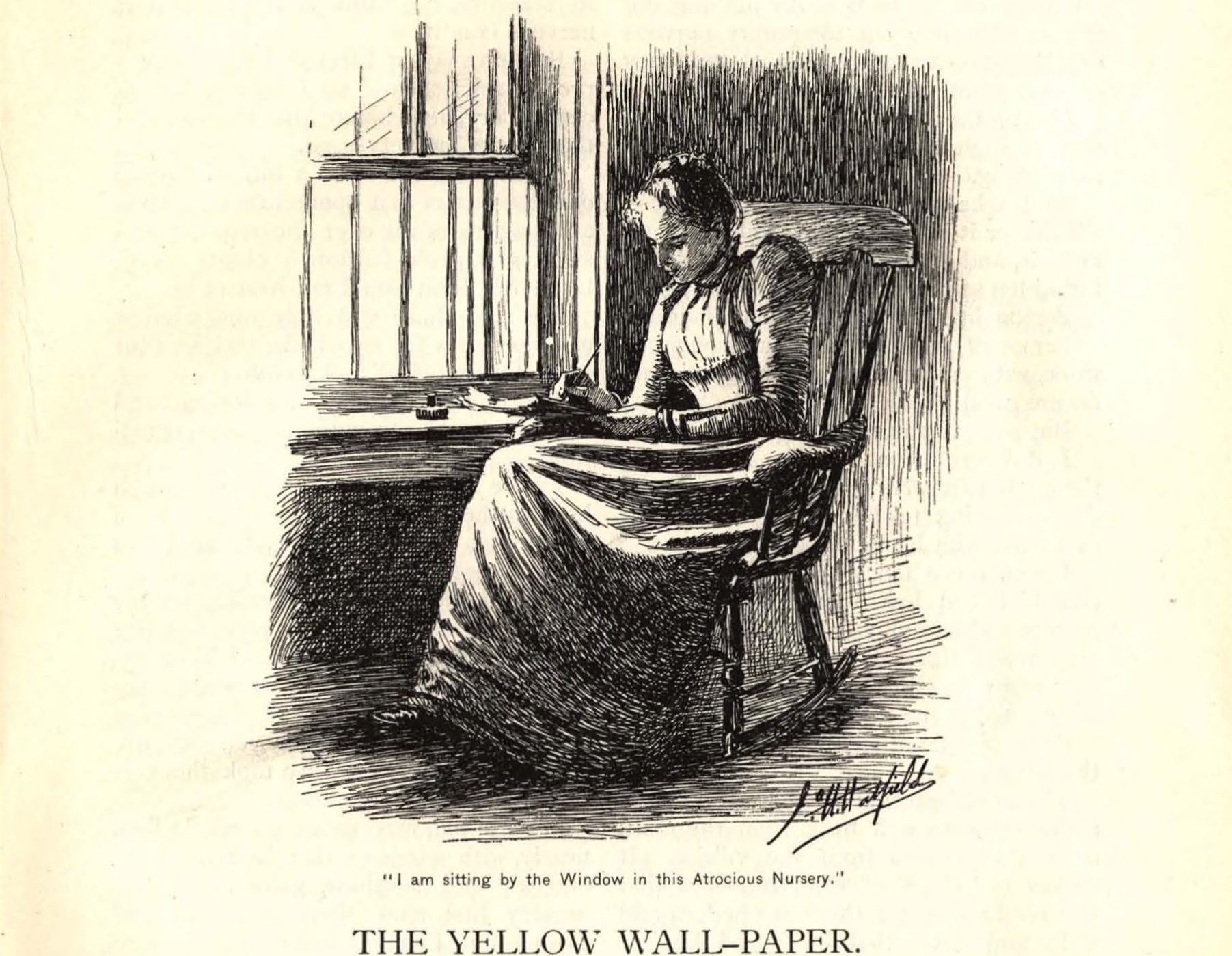
The voyage of Moncacht-apé
To celebrate the bicentennial of the Lewis and Clark expedition of 1803-06, Americans have created countless books, museum exhibitions, Websites, television documentaries, and tourism promotions. The hype devoted to Lewis’s dog Seaman is a veritable industry unto itself. But what if Lewis and Clark were not the first explorers to cross what became the continental United States? There is in fact a rival for this honor, a Native American explorer who has the potential to steal the limelight from those iconic figures of Manifest Destiny, and to inspire a debate about Lewis and Clark analogous to the controversies about Columbus, the supposed discoverer of America. The explorer was a Yazoo Indian named Moncacht-apé, and the narrative of his journey comes to us from a French historian of colonial Louisiana, Antoine-Simon Le Page du Pratz.
Le Page lived in Louisiana from 1718 to 1734, the first eight of those years at Natchez, Mississippi, where he lived with a Chitimacha woman, learned the Natchez language, and befriended local native leaders. Rather than describing the “manners and customs of the Indians” in the detached, homogenizing fashion of so many other colonial authors, Le Page recorded many pages of the words of his native informants, the Yazoo explorer among them. What Moncacht-apé told Le Page filled three chapters of his multivolume Histoire de la Lousiane, published in 1758. It first appeared, however, in a shorter version in August and September of 1752 in the Paris periodical Journal Oeconomique, two installments in a series of twelve articles that served as a draft or prospectus for his book.
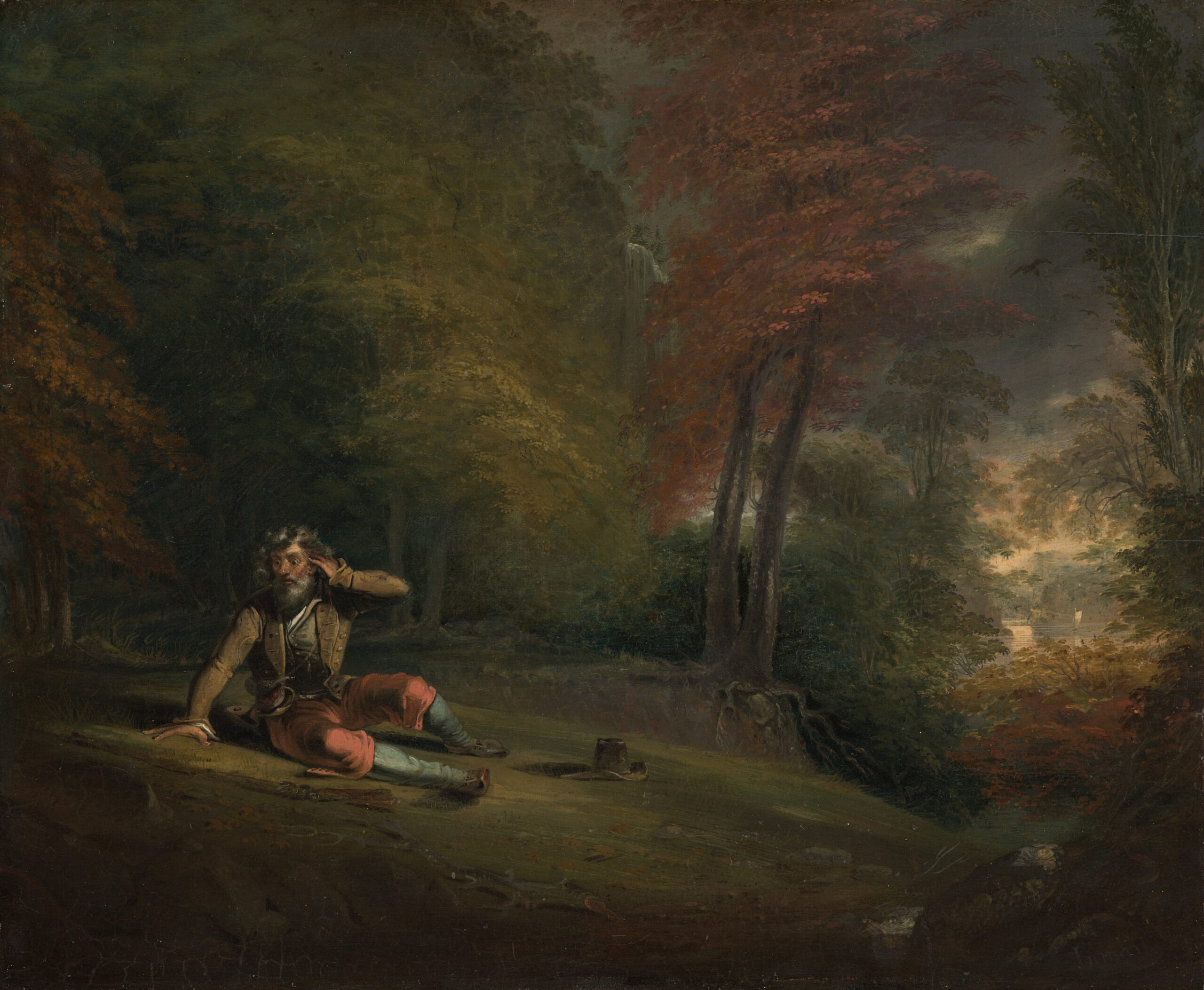
The name Moncacht-apé, Le Page wrote, “means ‘one who kills difficulties or fatigue.’ In fact, the travels of many years did not affect his physique.” Clearly the aptness of the man’s name impressed Le Page. He wanted to know more. “I begged him to repeat to me an account of his travels, omitting nothing,” and Moncacht-apé was happy to oblige (3: 88-89).
The motives for his journey had not been the familiar ones of exploration or trade. Rather, Monacht-apé had set out to learn about the origins of his own people. He began by asking the neighboring Chickasaw “if they knew whence we all came . . . they who are our ancestors” (3: 89). This question absorbed Le Page as well, for in his book and in the August 1752 article, the Moncacht-apé episode follows immediately after an exposition of his ideas on the longstanding controversy over the origins of the American Indians. Quoting at length speeches by the Natchez temple guardian and Great Sun explaining how the nation had migrated from Mexico, Le Page presented a theory that they were descended from an abandoned fourth-century-B.C. colony of Phoenician immigrants. This explained why the Natchez, with their strict caste hierarchy, differed so sharply from other nearby tribes, including the Yazoo. Le Page believed that ancestors of most American “naturels,” as he called them, had come across a land bridge linking Asia to Northwestern America.
Moncacht-apé set out northward in search of evidence of this migration. The first journey takes him up the Ohio River and past the Niagara Falls to the Atlantic Ocean. This episode does not appear in the 1752 version, however, where Moncacht-apé sets out straightaway up the Missouri River, a route that, since Joliet and Marquette’s initial descent of the Mississippi in 1673, had been identified by the French as the most promising for a transcontinental passage.
When Moncacht-apé reaches the “Canzés” or Kansas nation they inform him that it will take another month to reach the headwaters of the Missouri, and that from there he should walk for several days north until he finds a westward-flowing river, and that along this river he will find the Otter nation of Indians. His journey proceeds just as he is told, and the Otter people greet him warmly, help him to learn their language, and accompany him downstream. After eighteen days’ travel, he finds an unnamed tribe living in a grassy land with many dangerous snakes. Moncacht-apé winters here, and the following spring continues his descent of the Beautiful River, through other native villages, until he finally nears the Great Water (the Pacific), and meets a tribe that lives chiefly on fish. These folk keep their distance from the ocean however, for they must:
“be on the watch against the bearded men, who do all that they can to carry away young persons, doubtless to make slaves of them. They have never taken any men, although they could have done so. I was told that these men were white; that they had long, black beards which fell upon their breasts; that they appeared short and thick, with large heads, which they covered with cloth; that they always wore their clothes, even in the hottest weather; that their coats fell to the middle of the legs, which as well as the feet were covered with red or yellow cloth. For the rest they did not know what their clothing was made of, because they had never been able to kill one, their arms making a great noise and a great flame” (3: 116).
These dangerous visitors did not come for otter or beaver pelts, but for “a yellow and bad-smelling wood which dyes a beautiful yellow” (3: 117). The latter was evidently a dyewood analogous to the red brazilwood, although it is unclear what Northwest tree this might be.
Moncacht-apé joins an alliance of coastal tribes who are laying plans for an armed resistance against these invaders, and his experience with firearms, learned in French Louisiana, makes him a valuable military advisor. He instructs them to hide near a cove and wait for the bearded loggers to come ashore. When they do, Moncacht-apé and his friends attack and kill eleven men, and divide up the victims’ strange clothing, weapons, and gunpowder as booty.
After winning the confidence of the locals, Moncacht-apé continues farther along the coast toward the Northwest, where the summer days are very long. In the last village he reaches, a group of elders tell him that the coast extends a great distance farther to the northwest, and suggest that it once had been linked to Asia: “One of them [the elders] added that when young he had known a very old man who had seen this land (before the ocean had eaten its way through) which went a long distance, and that at a time when the Great Waters were lower (at low tide) there appear in the water rocks which show where this land was” (3: 127). With this Moncacht-apé has completed his quest, and has also confirmed Le Page’s idea of a land bridge migration to America, a theory that has grown in influence from José de Acosta’s 1590 Natural and Moral History of the Indies to the work of twentieth-century anthropologists. Moncacht-apé returns to Louisiana, and his narrative concludes with an estimation of the distance of his journey from the Mississippi River to the Pacific Coast.
Because his story was published just prior to the Seven Years’ War, which cost the French their Louisiana colony, Moncacht-apé did not inspire an exploratory expedition, and very few Americans have heard about him. In the 1763 English translation of Le Page du Pratz, The History of Louisiana, or of the Western Parts of Virginia and Carolina, the narrative of Moncacht-apé, like the rest of the book, was severely abridged. That version was reprinted in a few nineteenth-century books about American Indian history, such as those by Samuel Gardner Drake. Not until 1883 was a full English translation and analysis published in the Proceedings of the American Antiquarian Society by the amateur historian Andrew McFarland Davis. The story had “slumbered in the pages of Le Page du Pratz until it was revived by [French anthropologist M. A.] de Quatrefages” two years earlier (321). Davis concluded that “there is nothing in the story to tax our credulity if we are not called upon to believe in the annual visits of the bearded men and the various doubtful incidents which their presence involves,” and thus there is a “probability that the journey was actually accomplished” (348).
It is also probable that Moncacht-apé influenced Lewis and Clark. Thomas Jefferson had Le Page du Pratz’s book in his library, and Meriweather Lewis carried a copy of the 1774 English edition to Oregon and back. A couple of references in the letters and journals of the expedition reveal that he and Clark used the book and its map for information about the Padouca Indians and for the possible location of the French Fort Orleans, built by the explorer Etienne Veniard de Bourgmont on the Missouri River in the 1720s. But the papers of the expedition never mentioned Moncacht-apé by name. John Logan Allen in his 1975 Passage Through the Garden, a detailed study of the geographical knowledge consulted and acquired by Lewis and Clark, puzzled over this question: “While the only reference to the Du Pratz work that are found in the field journals of Lewis and Clark relate to the lower Missouri, the fact that the captains thought the book important enough to carry a copy with them raises the fascinating questions of how much faith they placed in the bizarre tale of Moncacht-apé . . . it is highly unlikely that they would have rejected it out of hand, because of the tremendous implications it had for their objective” (96).
Moncacht-apé had ascended the Missouri and made a portage to the Beautiful River without mentioning any high mountains or other barriers. This fit perfectly the optimistic plans of Jefferson. Perhaps it was the information in Le Page du Pratz that inspired Lewis to design and carry a folding boat. For he mistakenly believed that such a contraption could be easily carried between the headwaters of the Missouri and the westward flowing Columbia. But the fact was, these Europeans had no better information than what natives had provided them. In addition to the map in Le Page du Pratz’s book, Lewis and Clark carried a more recent map of the upper Missouri, made in London from a fur trader’s copy of maps drawn by a Blackfeet Indian named Ac Ko Mok Ki. So perhaps Lewis and Clark suppressed the name Moncacht-apé because they did not want to accept the possibility that they were not the first to make the trip.
Did Moncacht-apé really make this transcontinental journey nearly a century before Lewis and Clark? Or did Le Page du Pratz invent this Yazoo explorer and his remarkable narrative? I believe it is possible and even likely that some Native Americans did make such long journeys of exploration. Geographical curiosity is not confined to Europeans. My analysis of this question, like that of Davis, must compare not only the three versions of the narrative but also the maps and geographical theories behind them.
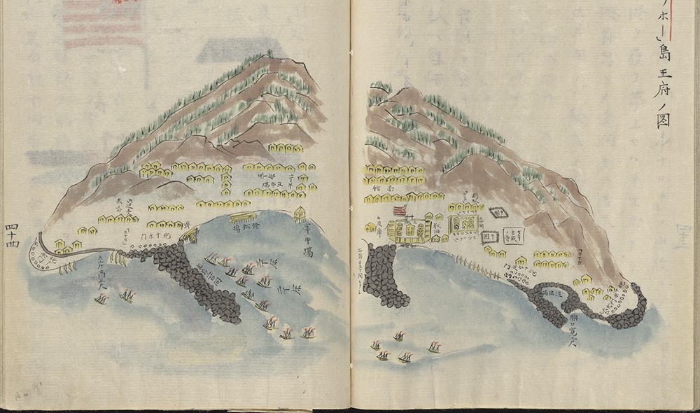
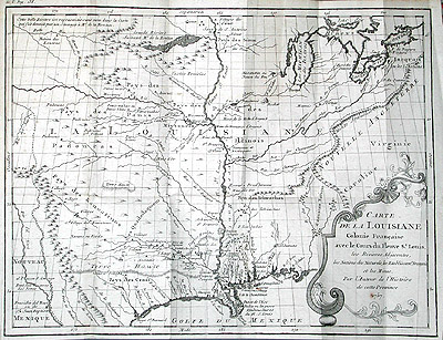
All through the eighteenth century, French, English, and then United States leaders badly wanted to find a practical trade route through the continent to the Pacific Ocean. The promise of trade with Asia was what had enticed Columbus, after all, and it became even more enticing in the 1740s when Russian fur traders began to take Otter pelts from the Alaskan coasts and sell them at huge profits in China. Moncacht-apé’s story clearly fed this dream, even if his narrative has significant gaps. He did not carry navigational instruments to calculate his latitude, and he did not provide Le Page du Pratz with a map of his journey. The fold-out map of Louisiana in the 1758 book (fig. 1) includes only the Gulf Coast and basins of the Mississippi, Missouri and Ohio Rivers. The geography of this unsigned map portrays the outlook of Le Page and the French colony by excluding all the English colonies on the Atlantic seaboard; blank space lies to the east of the Appalachian chain. The map does trace the route of Moncacht-apé from the upper Missouri river north to the Beautiful River, and it even shows a village of the “Loutre” or Otter nation. But that river exits off the upper right corner. Neither Le Page nor, evidently, Moncacht-apé, would commit to drawing the shape of the northwest coast of North America, which was still little known to Europeans.
Even so, the Le Page map constituted an important declaration about the contemporary geographical knowledge of North America. French cartographers since the 1720s had published maps showing a large Western Sea or “Mer de l’Ouest,” a huge inland bay joined to the Southern or Pacific Ocean through an apocryphal strait of Anian, a feature first described by a sixteenth-century Spanish explorer named de Fonte in a relation that was most likely a hoax. Philippe Buache, the French royal cartographer, had in 1752 published two treatises with maps, arguing for the existence of this Mer de l’Ouest just beyond the Rockies. It was to this imagined geography that Le Page du Pratz and Dumont de Montigny added their narratives of Moncacht-apé.
Moncacht-ape’s narrative first appeared in August 1752, the same month that Buache’s map (fig. 2) was presented to the French Academy of Sciences. In the shaded region in the center of the continent it shows a chain of lakes derived from the Indian informants of French fur traders in the 1730s and 1740s, and to the west of that lay the fabled Mer de l’Ouest as indicated by Buache’s father-in-law and predecessor as royal geographer, Guillaume Delisle. This sea is connected to the ocean through straits named for Spanish explorers de Fuca and d’Aguilar. The mythical city of Quivira, for which Coronado searched in the 1540s, appears on its shores. Moncacht-apé dissented from the geography of Buache and Delisle. Le Page wrote that Delisle’s map:
“does not at all agree with the relation that Moncacht-apé made to me of his voyage. The good sense for which I know him, who has no cause to mislead me, gives me faith in all that he told me, and I cannot persuade myself otherwise, than that he went along the coast of the South Sea, of which the more northern part might be called, if you will, the Western Sea. The Beautiful River that he descended is a considerable river, that one should have no difficulty in finding, as soon as one should come to the sources of the Missouri. And I have no doubt that a similar expedition, if it were undertaken, could fully establish our ideas about this part of North America and the famous Western Sea, of which everyone in Louisiana is talking about, and seems to desire so much to discover” (3: 137-38).
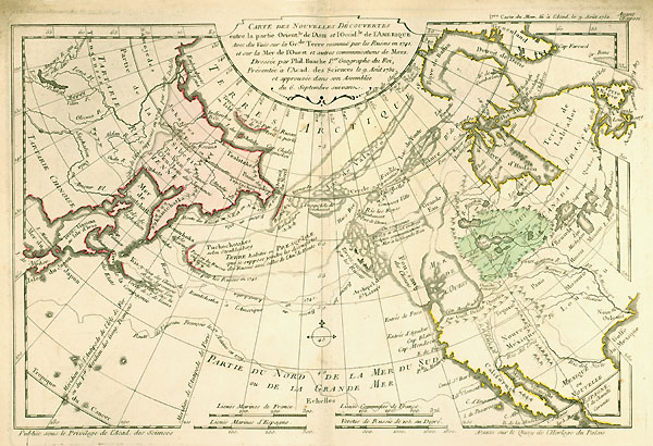
Thus Le Page had more trust in Moncacht-apé’s geography than that of some of France’s most celebrated cartographers.
The question of the authenticity of Moncacht-apé must remain unresolved, but I think it helps to see the question in light of a fundamental tension in the writings of colonial French Louisianans. Their better judgment led them to promote the promise of wealth from agriculture in the Mississippi Valley, mainly tobacco, indigo, and rice. But to lure more investors and migrants they had to offer seductive stories of precious metals or pelts or of a profitable trade with New Spain, and these promises relied in part upon native informants’ maps and voyages, information susceptible to exaggeration and misinterpretation.
The lines with which Le Page concluded the story of Moncacht-apé are instructive. After questioning the existence of the Western Sea, he wrote: “[W]hat advantages can we derive from our knowledge of this ocean? Would it be to our interests to go off to look for imaginary riches in a land that has not yet been discovered, whose soils will always be less fertile than those we already possess, and which we are neglecting? Let us put to use that which we have in hand. Will not a real value always be preferable to chimerical profits that must be sought at a great distance, and which may not even exist?” (3: 139-40). As a historian and promoter of Louisiana, Le Page’s primary goal was to promote its agricultural potential, not to look past it to the Pacific and Asia. And yet he could not resist the urge to do so, to complete the overland circle of a global imperial world.
Further Reading:
The quotations from Le Page du Pratz are from my Web-based translation of excerpts of The History of Louisiana. The Buache map was published in Considérations géographiques et physiques sur les nouvelles découvertes au nord de la Grand Mer (Paris, 1753) and is reproduced courtesy of the Newberry Library. Another tale of an indigenous transcontinental explorer, published well after Lewis and Clark, is John Dunn Hunter’s Memoires of a Captivity among the Indians of North America (Philadelphia, 1823). Quatrefage’s article about Moncacht-apé appeared in Révue d’Anthropologie 4 (1881). The story of Moncacht-apé has recently been expanded and embellished by Jonathan Reynolds Cronin to produce a 550-page narrative: Yazoo Mingo: The Journeys of Moncacht-apé across North America, 1687-1700 (Bloomington, 2003).
This article originally appeared in issue 5.4 (July, 2005).
Gordon Sayre is associate professor of English at the University of Oregon. He is currently working on an edition of the previously unpublished manuscript narrative of Dumont de Montigny, which does not mention Moncacht-apé.