Naming the Pacific: How Magellan’s relief came to stick, and what it stuck to
And God said, Let the waters under the heaven be gathered together unto one place, and let the dry land appear: and it was so. And God called the dry land Earth; and the gathering together of the waters called he Seas: and God saw that it was good . . .
And out of the ground the Lord God formed every beast of the field, and every fowl of the air; and brought them unto Adam to see what he would call them: and whatsoever Adam called every living creature, that was the name thereof.
—Genesis 1:9-10, 2:19, King James Version
From the beginning, the relationship between naming and waters has been unsettled. The Book of Genesis begins as formless abstractions emerge out of chaos. Light comes out of darkness, and the firmament divides the waters from the waters. To these abstractions, a self-satisfied God assigns the first proper names (besides his own): “God called the light Day, and the darkness he called Night . . . and God called the firmament Heaven.” These names—Day, Night, Heaven—are singular, as is the name God gives the dry land—Earth. But even though the waters under Heaven are “gathered together unto one place” to let the dry land appear, the name they receive is plural, at least in the English translation offered by King James: “the gathering together of the waters called he Seas.” Later, God creates the first man and hands him the task of naming the earth’s creatures. The man’s name, Adam, is mentioned for the first time in the very act of bringing Adam those creatures “to see what he would call them.” God gave Adam dominion “over every living thing that moveth upon the earth,” so naturally it was in Adam’s gift to name them. But if Adam named the fish, it was God who named the waters. And in his infinite wisdom he thought of them as plural and called them Seas.
In these origin myths, we can identify two questions pertinent to the uneasy relationship between waters and names. First, what gives human beings the authority, or the gall, to assign names to such inaccessible and incomprehensible entities as the seas? How can limited and puny mortals name these mysterious givers of sustenance, from which even the authors of Genesis realized that life emerged? The dominion that comes with naming seems somehow inappropriate for eternal rivers and boundless seas.
Second, even if it were appropriate for man to name the waters, what kind of name would the seas merit—one name or many, singular or plural? As the Genesis authors recognized, waters tend to “gather together unto one place,” which encourages us to think of them as singular. From earliest recorded times, some geographical theorists imagined the seas of the world to be one entity, the visible waters of the known world flowing into and surrounded by a vast ocean, a stream or river that encircled the world’s landmass. They recognized that this aqueous body lacked the obvious boundaries that lend confidence and ease to the practice of naming—we might as well name the air that we breathe as the sea that surrounds us.
Yet on the other hand, in the days when wind and sail provided the fastest means of travel, when continental and global circumnavigations lay far in the future, there was no obvious way to test whether widely separated seas, such as those that lay off the Arabian Peninsula and those of the Mediterranean, were in any way contiguous. Some thinkers consequently imagined them to be utterly separate entities. Ptolemy’s global geographical scheme envisioned the Indian Ocean as an enclosed sea, surrounded by Africa, Asia, and a great unknown southern land mass that connected southern Africa to Asia. From this perspective, it was quite natural to give these boundless yet separate bodies of water individual names. Even within bodies of water that the ancients could demonstrate were contiguous, different peoples gave different names to parts of the same waters—the Adriatic, Ionian, and Aegean Seas, for example.
I.
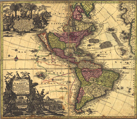
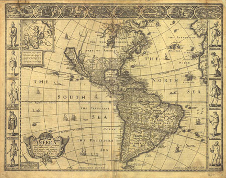
All these confusions still faced Europe’s fifteenth-century explorers who sailed westward out of the Mediterranean. Columbus drew encouragement for his voyages from his belief, one of several plausible geographical schemes of his era, that the Ocean Sea was very broad from north to south, but not very wide from west to east. He went to his grave believing that he had indeed sailed across it, and bearing the title that Ferdinand and Isabella bestowed upon him—Admiral of the Ocean Sea—for that was the name of the sea that he, before all other men, had mastered.
Of course, the explorers who sailed westward in Columbus’s wake, most of them Iberians, quickly realized the Admiral’s error and began to think of the Americas as a continental landmass, somewhere between the western ocean of Europe and Africa and the eastern ocean of Asia. With this dawning realization, and with the dramatic increase in ocean-going traffic beyond the Pillars of Hercules, came an increased need to name and chart the seas that Columbus sailed. Before the great age of exploration, the western ocean had sometimes been called “Atlantic,” a name derived from the Atlas mountains of western Libya, from which the Ocean River could be seen, as well as from the Greek myth of a lost island civilization, Atlantis, lying somewhere vaguely to the west of the Hellenic world. But Atlantic was by no means a universal or exclusive name for the seas Columbus sailed. The coastal voyagers of northern Europe had their own names for these waters: the Baltic, the North Sea, the Irish Sea. Early maps of what we think of as the Atlantic basin extended this practice, naming the Sea of France, or Mare Gallicum, for instance. South of the equator, the waters navigated by the Portuguese as they made their way toward and then around the Cape of Good Hope were commonly called the “Ethiopian Sea,” a name that lasted well into the eighteenth century. And Columbus’s first discoveries were quickly added to the list as the Antillean Seas. In other words, although “Atlantic” was in play from the beginning, it was but one name among many for the waters that were now a highway to New World wonders.

Spain soon came to dominate both the wonders and the wealth of these new worlds, and the center of Spanish transatlantic operations lay in the maritime basin formed by the northern coast of South America and the islands of the Antillean chain, from Cuba in the northwest to Trinidad in the southeast. The northern coast of South America, stretching a thousand miles from the mouth of the Orinoco in the east to Darien in the west, the Spanish called Tierra Firme, the mainland, translated by the English as the “Spanish Main.” . The sea to its north was called, quite naturally, the “North Sea,” Mar del Norte, by its Spanish masters. Over time, the name for this central sea of the Spanish Empire became the general name for the entire basin between Old Spain and New, so that maps from the sixteenth and seventeenth centuries commonly referred to the entire Atlantic as the North Sea—Mar del Norte. As late as the 1690s, even the southernmost regions of the Atlantic, the waters to the east of Argentina and Tierra del Fuego, were labeled as Mer de Nort in a French atlas.
II.
As Spanish conquistadors gradually took possession of Tierra Firme, the native peoples they encountered began to inform them of another body of water, a great sea comparable to the North Sea that Spain now controlled. In 1511, Vasco Núñez de Balboa, one of several Spanish overlords competing for control of the native caciquesor chieftains of the Darien region, visited the domain of Cacique Comogre, where he heard Comogre’s eldest son Panquiaco tell of golden treasures that could be found in lands to the south, across the mountains of the Darien Isthmus and the sea that lay beyond. Based on these early reports of the riches of the Incas, Balboa organized an exploratory expedition that departed Darien on September 1, 1513. After nearly a month’s overland journey, they came to a hill overlooking the Gulf of San Miguel, whence Balboa could look out toward the Bay of Panama, large enough in its own right, but only a small coastal indentation of an ocean the vastness of which Balboa could not possibly have imagined.
What to call it? Balboa’s journey across the isthmus had roughly gone from north to south, and the sea he left behind him was the Mar del Norte. Balboa therefore called the waters beyond the Gulf of San Miguel the “South Sea.” Balboa did not so much name this new ocean as give utterance to what it was already called by necessity of the convergence of Spanish and Native American histories. From that moment onward, as Balboa’s fellow conquistadors seized the realm of the Incas, Spain neatly divided the waters that bounded its growing empire into the Mar del Norte and the Mar del Zur, the North Sea and the South Sea.
Balboa’s expedition made it possible for Spain to double its New World empire into symmetrical northern and southern regions, but it did nothing to indicate whether this new South Sea bore any relation to the North Sea. Nor was there yet any certainty that Balboa’s South Sea was part of the Eastern Ocean of the Indies. The navigational triumph of Fernáo de Magalháes, the Portuguese nobleman who had formerly served in India and Morocco, and who set sail for Charles I of Spain in 1519, would begin to provide such a reason. Ferdinand Magellan’s search for the southwest passage that might link the North Sea with the South Sea, the Western Ocean with the Eastern Ocean, came to fruition in the straits that he named for himself.
The waters of these narrows were so tempestuous that when, at last, Magellan’s fleet of three vessels broke free of the straits, beat their way off the rugged coast of Chile, and entered into the calmer waters of the open ocean, the captain in his relief named the sea “Pacifico.” Or so we learn from Antonio Pigafetta, the Italian who accompanied Magellan and survived the circumnavigation to write an account. It is Pigafetta who tells us that the open sea they crossed “was well named Pacific, for during this same time we met with no storm.” The only other surviving logbook from the expedition to name these waters, that of Francisco Albo, calls it the “South sea.”
Based on contemporary maps and globes that he might have seen, Magellan may have believed that he would cross this sea and arrive in the Indies in a matter of days, or perhaps a few weeks. On this score, he was wrong. But by sailing to the northwest for the next three months, reaching first the Marianas Islands and then later the Philippines, where he was killed, Magellan proved conclusively that Jehovah and the ancient Greeks were right. The seas had been gathered together unto one place, and ocean encircled the land masses of the world.
As a navigational achievement, Magellan’s voyage rivaled that of Columbus, and he, perhaps more than Columbus, deserved the title of Admiral of the Ocean Sea. But the name he gave to the peaceful waters off the western coast of Chile did not yet become the name for the basin of the Eastern Ocean. For more than two centuries, mapmakers and navigators would continue to make the South Sea the common label for the waters west of the Americas and east of Asia. There are several reasons for this. First of all, Magellan’s name was not so apt; often the waters west of the straits were anything but peaceful. Francis Fletcher, who accompanied Francis Drake on his global circumnavigation in the 1570s, thought that “Mare furiosum” would have been a better name than “Mare pacificum.”
Another explanation lies in the fact that it took more than two centuries for explorers to chart the limits of the Pacific, and until that time, South Sea remained a plausible and useful description. For Europeans to reach these waters, ships had to sail to the south for a tremendous distance. For the Spanish fleets that maintained a dominant presence in this region through the sixteenth, seventeenth, and eighteenth centuries, most of the maritime traffic connected the southern reaches of their empire, the Viceroyalty of Peru, to the central and northern regions of the Spanish Main and Mexico. Beyond this north-south Spanish axis, the rest of the coastal territories of the Pacific basin remained almost completely unconnected by any regular traffic.
The sole exception to this rule was the annual voyage of one or two Manila galleons that struggled back and forth across the South Sea from Acapulco to the Philippines. The Manila galleons carried Peruvian and Mexican silver to the markets of Asia, and the spices and silks of the Indies back to New Spain, a journey lasting six months in each direction. But in the quarter millennium (1565-1815) that they traversed the Pacific, the crews of the Manila galleons never came upon the Hawaiian Islands, never charted the islands and coasts of the unknown Pacific reaches. Their solitary journeys created a fragile trading channel between East Asia and South America, an oceanic equivalent of the Silk Road, but they did not create a Pacific World that could readily be described, much less named.
The discontinuity of the Pacific was maintained in part by the indifference of Asians to their far-eastern waters. Japan, perhaps the most quintessentially Pacific of the world’s modern nations, largely withdrew from international affairs during the Tokugawa Shogunate (1603-1868), and even before that time, its overseas connections were directed almost exclusively to the westward. Although heavily dependent on the surrounding waters for sustenance, the Japanese, unlike other island or coastal nations (Britain, the Netherlands, Portugal), were not great long-distance seafarers. The currents that swirled around the home islands tended to push wayward Japanese sailing ships into treacherous waters and then out into the open ocean, never to return. Early modern Japanese maps divided that ocean into the small eastern sea, the familiar waters that they fished and that linked them to the Asian continent, and the large eastern sea, a frightening, boundless, and uncharted maritime region with no people and no points of interest. Similarly, China, the Middle Kingdom of the Asian world, took a strong trading and imperial interest in southeast Asia, Indonesia, and the Philippines, where it encountered the tiny outpost of Spanish traders in Manila. But the Chinese played no active role in world exploration after the great fleets led by Admiral Cheng Ho in the early fifteenth century sailed west to the African coast of the Indian Ocean, but not east beyond Japan.
Finally, although Magellan’s global circumnavigation had proven that the world’s waters were one, he had not disproven the long treasured geographical theory of a great southern continent, a landmass that would be the symmetrical parallel of the Eurasia-Africa ecumene. So long as Australia remained unexplored and the southern limits of the oceans remained unknown, belief in the existence of a Terra Australis held firm. Most of the naming of the waters throughout history involved the extension of the names of land regions onto the seas. So if there was a large and as yet uncharted continent at earth’s southern extremity, then it made sense to call the waters around it the “Southern Ocean” or the “South Seas.” Maps of the sixteenth and seventeenth centuries therefore often restricted names such as the “Indian Ocean” to the waters relatively near India, and called the waters between southern Africa and Indonesia the “Southern Ocean,” out of respect for this theory.

European exploration party after another ventured out through the Straits of Magellan in the eighteenth century, they thought of the waters they sailed into as the South Seas. In 1740, British naval officer George Anson led a four-year expedition to sail around the world. In the official account of the voyage, probably ghost-written by Anson’s chaplain, Richard Walter, the South Seas were the primary destination. “Within the limits of the southern Ocean,” Walter expected to find the “celebrated tranquility of the Pacifick Ocean” just to the west of the straits where Magellan had found them, “but these were delusions which only served to render our disappointment more terrible.” A generation later, in 1767, Louis-Antoine de Bougainville, formerly an aide-de-camp to Montcalm in Quebec, commanded a major French exploratory party on a two-year mission through the Straits of Magellan and on to circumnavigate the globe, accompanied by Charles-Nicolas-Othon d’Orange, the Prince of Nassau. In their journals and accounts of the voyage, Bougainville and Nassau referred to the waters beyond the straits as “the South Sea.” Even as late as 1815, when Otto von Kotzebue led a Russian naval expedition on a voyage of discovery looking for a “north-east passage,” they thought of their destination as the South Sea. And as a literary convention, the name lasted well into the nineteenth century; Herman Melville, Edgar Allan Poe, and Robert Louis Stevenson all used “South Seas” rather than “Pacific” in the titles of their works.
The direction that Enlightenment geography was taking made it increasingly unlikely that “Pacific” would overtake “South Sea” as a common name for this ocean. Beginning in the 1690s and continuing through much of the eighteenth century, many European geographers took to naming the waters not by the vast ocean basins familiar to us today, but rather by what the modern geographer Martin W. Lewis calls the “ocean-arc” concept. In this scheme, oceans are thought of as the waters that wrap around the edges of integrated landmasses, rather than as the empty seas between continents. For example, the Ethiopian Ocean in this model wraps around southern Africa, and therefore includes parts of what we would call the Atlantic and Indian Oceans. In similar fashion, a 1719 French atlas described the Mer Magellanique as a single sea that encircles the entire southern tip of South America. The value of this ocean-arc concept lay in the fact that these arcs often corresponded to actual maritime pathways of human activity. If this theoretical trend had continued to prevail, there might never have been a reason to construct an oceanic basin to which the label “Pacific” would plausibly apply.
What challenged this model were the remarkable voyages in the 1770s of Captain James Cook, remarkable as much for what Cook failed to discover as for what he found. Part of Cook’s purpose in making his three voyages to the South Seas was to prove, once and for all, whether the great southern landmass about which geographers had speculated for millennia actually existed. Although Cook erred in thinking that the Antarctic he explored was all ice and no landmass, his explorations around Australia and New Zealand and his circumnavigation of Antarctica proved that Australia was not the northern edge of a great southern continent. There was no such landmass and therefore no obvious need to name a great southern ocean after it.
In his third and final voyage, Cook explored the northern reaches of the Pacific, searching for the fabled Northwest Passage that would easily link Europe with the Far East. Before that time, Spanish explorers had been inching their way up the west coast of North America, and Russians had been slowly moving east and south from Alaska, but without linking the basin together as a connected and integrated whole. Cook’s careful mapping changed all that. He did not find a Northwest Passage, but he did chart the northern reaches of the Pacific before his untimely and much debated demise at the hands of Hawaiian islanders in 1779.
Over the course of Cook’s three voyages, something seems to have changed about European perceptions of the Pacific, or at least about what westerners were willing to call it. Cook himself, in his report to the secretary of the Admiralty after his first voyage, hoped that “this Voyage will be found as Compleat as any before made to the South Seas.” Similarly, Sydney Parkinson, who accompanied Joseph Banks as a “draughtsman” aboard the Endeavor on Cook’s first voyage, published a journal that he called A Voyage to the South Seas. But when Connecticut native John Ledyard sailed on board the Discovery for Cook’s last and fatal voyage in 1776, he called his account A Journal of Captain Cook’s Last Voyage to the Pacific Ocean.
After Cook’s death, subsequent maps much more frequently applied the word “Pacific” to the entire basin, and “South Seas” became increasingly literary, a romantic term most often used for the regions around the islands in the central and southern latitudes of the Pacific. Where Anson and his crew had expected to find “Pacifick” waters within the great Southern Ocean, now people began to think of the South Seas as an exotic portion of the well-charted Pacific Ocean. In short, Cook’s accomplishments made it possible (if not necessary) for everyone from geographers to ordinary folks to imagine the Pacific as we now know it: as the entire basin between the Americas on the east and Asia and Australia in the west. To this singular sea they increasingly gave a single definitive name that reshuffled and replaced older habits.
Consider, for instance, Lieutenant William Reynolds, a young naval officer from Lancaster, Pennsylvania, who took part in the U.S. exploring expedition of 1838-42 under Captain Charles Wilkes, the first international maritime survey conducted by the United States. Wilkes and his fleet of six sailing ships followed in Cook’s wake and charted for the first time large portions of the Antarctic coast and the islands of Polynesia. Lieutenant Reynolds wrote frequent letters home to his family in Pennsylvania, letters with real dramatic flair and style. His literary aspirations were aided by the fact that on ship, the crew had access to “the Histories of all the French and English expeditions to the Seas we are to visit.” Most of these histories of course labeled the ocean to which Reynolds was heading as “the South Seas.” But Reynolds had a different sensibility from many of his ocean-going forebears, formed in part by his reaction to their writings. Less than a month into his voyage, Reynolds described the inspirational beauty of these volumes, “published by the respective Governments in superb style, full of plates, colored and plain. I have been looking over them and only wish that we were now among the Islands: ah! we shall have a glorious time, wilder than the romance of imagination.”
As the ships neared Cape Horn, the weather worsened but Reynolds’s excitement mounted as “those indefinable sensations that set one’s heart a throbbing while viewing new and striking scenes were dancing through my veins.” At long last, they rounded the Cape: “We had fairly doubled it!” In his ecstasy, Lieutenant Reynolds had no doubts about what name to call the waters he now entered, but his comments about the ocean’s appearance suggest a tinge of disappointment, a vague unease that cycles us back to the beginning of our story, to the fundamental ambiguities surrounding the naming of the seas. Quoth Reynolds, “[F]or the first time I found myself in the Pacific Ocean—it looked very like the Atlantic!”
Further Reading:
This essay would not have been possible without the insightful work of Martin W. Lewis in “Dividing the Ocean Sea,” The Geographical Review 89, no. 2 (April 1999): 188-214. Lewis’s essay appears in a valuable special issue of The Geographical Review entitled “Oceans Connect,” which also includes Marcia Yonemoto’s “Maps and Metaphors of the ‘Small Eastern Sea’ in Tokugawa Japan,” 169-187, the source for information on Japanese and Chinese understandings of the Pacific in this article. J. H. Parry, The Discovery of the Sea (Berkeley, 1981), offers an introductory discussion of the evolving problem of knowledge of the seas. On the Spanish Main and the naming of the Atlantic, see Carl Ortwin Sauer, The Early Spanish Main (Berkeley, 1966), and for a general overview of Spanish expansion into the Pacific, including a discussion of the Manila galleons, see Henry Kamen, Empire: How Spain Became a World Power, 1492-1763 (New York, 2003).
Balboa’s discovery of the South Sea is described in Charles L. G. Anderson, Life and Letters of Vasco Núñez de Balboa (1941; reprint, Westport, Conn., 1970). For Magellan’s voyage and Pigafetta’s commentaries, see The First Voyage Round the World by Magellan, translated from the Accounts of Pigafetta, trans. by Lord Stanley of Alderley (London, 1874), 65; as well as a recent popular narrative, Laurence Bergreen, Over the Edge of the World: Magellan’s Terrifying Circumnavigation of the Globe (New York, 2003). Francis Fletcher’s critique of Magellan’s “Pacific” is found in The World Encompassed by Sir Francis Drake (1628), ed. by W. S. W. Vaux (London, 1854), 82. Several recent accounts deal with the fleets led by the Chinese Admiral Cheng Ho, including the fanciful Gavin Menzies, 1421: The Year China Discovered America (New York, 2003). On George Anson’s circumnavigation, see Richard Walter and Benjamin Robins, A Voyage round the World . . . by George Anson (London, 1974). Bougainville’s expedition is described in John Dunmore, ed., The Pacific Journal of Louis-Antoine de Bougainville, 1767-1768 (London, 2002), and details on the Russian expedition of 1815-18 can be found in Otto von Kotzebue, A Voyage of Discovery into the South Sea and Beering’s Straits, 3 vols. (1821; reprint, New York, 1967).
The literature on Cook’s voyages is voluminous, but see the handsome and lavishly illustrated J. C. Beaglehole, ed. The Journals of Captain James Cook on his Voyages of Discovery, 5 vols. (Rochester, N.Y., 1999). For the most recent analytical biography of Cook, see Nicholas Thomas, Cook: The Extraordinary Voyages of Captain James Cook (New York, 2003). Finally, William Reynolds’s charming letters and his profound description of the resemblance between the Atlantic and Pacific are found in Voyage to the Southern Ocean: The Letters of Lieutenant William Reynolds from the US Exploring Expedition, 1838-1842, ed. by Anne Hoffman Cleaver and E. Jeffrey Stann (Annapolis, 1988), 11-12, 55. For a general account of the U.S. exploratory expedition of 1838-42, see Nathaniel Philbrick, Sea of Glory: America’s Voyage of Discovery, The U. S. Exploring Expedition, 1838-1842 (New York, 2003).
This article originally appeared in issue 5.2 (January, 2005).
Mark Peterson teaches history at the University of Iowa and is the author of The Price of Redemption: The Spiritual Economy of Puritan New England (Stanford, 1997) and “Puritanism and Refinement in Early New England: Reflections on Communion Silver,” William and Mary Quarterly, 3d ser., 58 (April 2001): 307-46. He is working on a history of Boston in the Atlantic world that spills over into other oceans as well.