Salt and Deep History in the Ohio Country

George Bluejacket was living at Wapaughkonnetta, Ohio, in 1829 when he recorded the history of the Shawnee people. Son of the famed eighteenth-century leader of the same name, Bluejacket devoted much of his narrative to explaining what had enabled Shawnees to endure and thrive in what was known during the eighteenth century as the Ohio Country. The region, Bluejacket explained, abounded with se-pe (rivers), me-to-quegh-ke (forests), and different animals—a reflection of the region’s bounty of life-giving resources.

However, Shawnee origins, according to Bluejacket, began not with rivers, land, or forests, but with saltwater. Long ago, the Shawnees’ Go-cum-tha (grandmother “of our people”) came out of a great salt sea holding the tail of Ne-she-pe-she, a giant panther. The Wash-et-che (husband) of Go-cum-tha soon followed, “carried to the shore by a very big Wa-be-the (Swan or Goose).” Their terrestrial tranquility did not last long. Watch-e-mene-toc, a bad spirit, used the great salt water to flood Go-cum-tha and her Wash-et-che’s home until everything “was swallowed up.” But Mish-e-me-ne-toc, “the Great God or Good Spirit,” did not let Go-cum-tha and her Wash-et-che drown; the Good Spirit saved them, as well as “many animals and birds.” Go-cum-tha and her husband enjoyed “plenty of hunting in the new me-to-quegh-ke (fForest)” salvaged by Mish-e-me-ne-toc. Referring to themselves as the Water People, Shawnees—Go-cum-tha and her Wash-et-che’s descendants—did not lose everything to the great salt water. Instead, they made their home upon the old sea floor. (Figure 1)

Figure 1. Flag of the Eastern Shawnee Tribe of Oklahoma. The flag depicts a panther and a white swan, both of which play a major role in George Bluejacket’s 1829 narrative of Shawnee origins. Public domain, via Wikimedia Commons.

Bluejacket’s telling pointed to a geological truth that would take geologists more than a century to even consider. Modern geology now affirms that parts of present-day West Virginia, Kentucky, and Ohio once constituted the floor of the Iapetus Ocean, a 600-million-year-old extinct body of water that preceded the formation of the Atlantic Ocean. The Iapetus once separated the ancient continents of Avalonia and Laurentia. Roughly 420 million years ago, tectonic activity brought these two landmasses together, closing the Iapetus and trapping saltwater under a new supercontinent, Pangea. Pangea eventually separated, forming the distinct continents of Africa and North America and the ocean that now separates them. The salty waters and residue of the Iapetus became locked beneath the central Appalachians and have gradually seeped upward through millions of years of geologic history, re-appearing at the earth’s surface in the form of licks, springs, and seeps.

Lands bounded in by the Appalachians to the east, the Mississippi River to the west, the Great Lakes to the north, and roughly the Cumberland River to the south constitute an uncommonly salt-rich region of North America. These mineral pockets became magnets of human and nonhuman migration to and across Bluejacket’s ancestral lands. This is because large mammals, like humans, need salt to survive. Though it can vary in compound structure and mineral ratio, all forms of salt consist primarily of sodium and chloride. Sodium chloride—salt’s main homogenous compound—allows animals to retain hydrating fluids, process essential nutrients and minerals, and support microcellular processes critical to circulatory, muscular, and nerve function. Humans reliant upon large mammals for food recognized this dependency: “in all the western states,” one early nineteenth-century visitor to Kentucky observed, “they are obliged to give salt to the cattle. Were it not for that, the food they give them would never make them look well.”

In the Ohio Country, salt commonly took the form of mineral-rich mud or saline springs. Most large mammals in the region consumed their fill at mineral licks. American settler John Filson, for instance, wrote in 1784 that “Noblick, and many others, do not produce water, but consist of clay mixed with salt particles; to these the cattle repair, and reduce high hills rather to valleys [then] plains.” Even if mundane in purpose, salt licks were miraculous sights to behold. Filson wrote of the “amazing herds of Buffalo” that came to the licks, and how “their size and number, fill the traveller with amazement and terror, especially when he beholds the prodigious roads they have made from all quarters, as if leading to some populous city; the vast space of land around these springs desolated as if by a ravaging enemy, and hills reduced to plains.” Filson wasn’t fabricating; on May 18, 1774, a British survey party travelled up the Kentucky River “to a Salt Spring, where [they] saw about 300 Buffaloes collected together”—sights, smells, and sounds no doubt seared into the surveyors’ senses.

Because they attracted large mammals, mineral licks also attracted hunters. This had been the case at Big Bone Lick for at least centuries—and possibly over 10,000 years—prior to European arrival. Located just south of the Ohio River in present-day Boone County, Kentucky, Big Bone earned its English name from massive skeletal exposures that captured the awe and attention of both Indigenous peoples and Euro-American newcomers. In a 1762 letter, James Wright relayed the origins and significance of Big Bone Lick according to “two Sincible Shawanese Indians”:

There were many roads thro this Extent of land, larger & more beaten by Buffolas and other Creatures, that had made them [Shawnees] to go to it . . . they [Shawnees] had indeed a tradition, such mighty Creatures, once frequented those Savannahs, that there were then men of a size proportionable to them, who used to kill them, and tye them in Their Noppusses [back straps] And throw them upon their Backs As an Indian now dos a Deer, that they had seen Marks in rocks, which tradition said, were made by these Great & Strong Men, when they [sat] down with their Burthens . . . that when there were no more of these strong Men left alive, God had Kill’d [the] last 5 [buffalo] . . . they [Shawnees] supposed them to have been Killd by lightening — these the Shawanese said were their traditions.

Thousands of years of migration to and from Big Bone remained visible—and useable—in the mid-eighteenth century. Visiting the lick in the early 1760s, British trader George Croghan commented on the “large road which the Buffaloes have beaten, spacious enough for two wagons to go abreast and leading straight into the Lick.” Apparently unbeknownst to Croghan, four roads converged at Big Bone, each up to fifteen feet in width. The most important road crossing through Big Bone was Alanant-o-wamiowee (the Great Buffalo Path), one of the oldest in eastern North America. The corridor originated somewhere in present-day Illinois, where bison converged by the millions to migrate toward Kentucky and Tennessee. The path spanned 225 miles across northern Kentucky, connecting at least four major springs and licks along the way.

Like stars, salt resources oriented the movements of mammals and their hunters for millennia. The result was an intricate web of trails, traces, and roads that facilitated and directed human movement. Reconstructed maps of Indigenous roadways through northern Kentucky show paths starting and ending at places like Es-kip-pa-ki-thi-ki and Upper and Lower Blue Licks, all sites of major salt springs and licks. Shawnees had departed the Ohio Country during the early seventeenth century in response to war, disease, and political instability. We may imagine their eventual return to places like Lower Shawneetown, at the confluence of the Scioto and Ohio rivers, occurred along these familiar pathways. Through the eighteenth century, Shawnees continued to reinforce the significance of these veritably ancient networks. 

Figure 2. Lewis Evans, A General Map of the Middle British Colonies, in America (Philadelphia, 1755). In the middle and lower left portions of the map, Evans demarcates Shawnee territory that spans across the Ohio River; Evans also locates “salt” and “coal” directly beneath Lower Shawneetown, “Elephant Bones” at the site of present-day Big Bone Lick, and a number of pathways connecting places like “G. Buffalo Lick” and “Eskippakithiki.” Public domain, retrieved from the Library of Congress.

Salt production was also part of the diverse economies dominated by Indigenous peoples in the eighteenth-century Ohio Country. This was especially true at Lower Shawneetown, where its residents engaged in a generations-old practice of exploiting rich local springs. Visiting the bustling Lower Shawneetown in January of 1751, British trader Christopher Gist noted that “The Indians and Traders make salt for their horses” from a local spring “by boiling it.” As A. Gwynn Henderson has demonstrated, local salt makers seemed to have replaced their shallow ceramic pans, which their predecessors had used since at least the 1100s through the early seventeenth century, with kettles by the mid-eighteenth century. When a hunting party departed Lower Shawneetown for Big Bone Lick in 1755, for instance, they took kettles and two captured colonists with them “to make salt.” Perhaps they intended to use the salt to treat hides, season or preserve meat, or supplement their trading wares.

Salt making was no small task. Even the strongest, cleanest brine required close watch, constant maintenance, and physically demanding labor to ensure a useable final product. As Susan Sleeper-Smith and A. Gwynn Henderson have suggested, salt making seems to have been one of the many industries managed by Indigenous women in the Ohio Country. Perhaps that is why one group of Shawnees, who captured Daniel Boone and a group of squatters in the winter of 1777-1778, forced the male captives to make salt while travelling northward along the Scioto River. Whether it was the physical taxation or the embarrassment of doing women’s work under the orders of Indigenous men, the captives came to resent the task of salt making. One captive, James Callaway, refused to carry kettles and salt forfeited by William Brooks. When a Shawnee man took out his tomahawk, Callaway responded with dramatic defiance—“strike! I would as lie here as go along, and I won’t tote your kettle”—after which the salt-making gear was assigned to someone else.

If salt making supported the economic primacy of Indigenous women within their communities and networks, it could also make them targets of gendered colonial violence. In early 1778, a group of Munsee Delaware women were making salt at a spring near the Mahoning River when American soldiers murdered them. Intended to be a retaliative campaign against British-allied Seneca and Cayugas, American general Edward Hand’s bloody foray into the eastern Ohio Country reached a sinister climax at the Mahoning spring, where the women, according to American correspondence, were tragically misidentified as potential enemies. The soldiers’ actions and justifications laid bare the violence Indigenous women faced as colonialism intensified in the Ohio Country. In the minds of their killers, the women’s presumed affiliation with male-dominated warfare rendered their lives discardable, relevant only as tokens in conflicts among men. Yet the women’s unguarded presence at the spring reminds us that Indigenous women in the Ohio Country often moved, labored, and acted autonomously. In doing so, the Munsee Delaware women also reinforced this particular spring’s place within Indigenous spheres of knowledge, movement, and management. 

Figure 3. Elbert S. Mowery, Pioneer Salt Gourd, 1935-1942. Mowery’s sketch is based on an actual eighteenth-century salt gourd recovered from Kentucky. See Mel Hankla, “A Pumpkin Salt Gourd,” in Kentucky by Design: The Decorative Arts and American Culture, ed. Andrew Kelly (Lexington, KY: University Press of Kentucky, 2015), 187-88. National Gallery of Art, CC0, Public domain, via Wikimedia Commons.

American invasions mark the start of a more widely known chapter in the history of salt in the Ohio Country. Between 1780 and 1790, dozens of saltworks cropped up throughout the Ohio Country. Digging wells, expanding furnaces, and siphoning brine, settlers considered themselves titans of industry and tamers of wilderness. Early settler James Collins, who founded a saltworks near Goose Creek in 1785, wrote in a letter to a colleague “of the early times about Bullitt’s Lick—when the fires of an hundred salt furnaces gleamed through the forest, and the Wyandot sat on Cahill’s [K]nob and looked down on five hundred men on the plain below.” One late nineteenth-century historian alleged that “the Indian hated to see the white man thus engaged” in salt making at Bullitt’s Lick because “it seems like an invasion of the rights of the owner of the soil, and the very industry of the settler was a perpetual reproach.” In addition to severing connections that were thousands of years old and suffocating local environments, these operations also attracted more settlers and provisioned local militias, thus functioning as critical nodes of settler colonial sustenance and commerce.

Indigenous peoples repeatedly rejected such disruptions. In 1780, for instance, “a company of Indians” attacked a group of American men who “were on their way from Bryan station and the fort at Lexington to Mann’s Salt Licks . . . for the purpose of procuring salt.” A similar episode occurred in April 1783, A similar episode occurred in April 1783, when American Colonel John Floyd as well as his brother and another person “going to the [Bullitt] Saltworks were fired on by Indians,” an attack that quickly proved fatal for both Floyd and the unnamed third person, each of whom died right at Bullitt’s Lick. Between 1781 and 1788, vaguely identified “Indians” travelling to and from the Ohio River targeted at least two salt-making parties and another group surveying lands with potentially useable licks and springs.

The attacks prompted white men living and laboring in upper central Kentucky’s salt industry to seek state protection. In May 1793, some 75 residents petitioned to Kentucky governor Isaac Shelby for “a guard of men to be stationed at the mouth of Salt River.” The petitioners “apprehend[ed] but little danger from any other quarter than from the westward of the Ohio,” which was “the general crossing place for the Indians . . . doing mischief on any part of this frontier.” Whether Shelby ever provided state protection at Bullitt’s Lick is uncertain, but Indigenous men did not readily relinquish their ability to move and mobilize power south of the Ohio River. As late as March 28, 1795, the Kentucky Herald reported the “last Indian depredations” in Clay County, a commercial pocket in the heart of the state. “A gentleman just from the salt works,” wrote the Herald, had described how “the Indians stole a number of horses from that place last week, and that they also killed a man on Goose creek.” 

Figure 4 Richard Graham, Lands. Lands to be rented, or for sale, Dumfries (Dumfries, 1789). In this broadside, Graham solicits leases for multi-thousand-acre tracts in lands that, after 1792, became the state of Kentucky. Tracts no. 5 and 8 highlight local salt springs; tract no. 6 describes land that “has contained the most populous Tribe of Indians that were formerly settled on any Part of the Ohio River, from the amazing Extent of old Fortifications, &c. that still remain there; one of the old Works has a covered Way of 300 feet long.” At the bottom of the broadside, Graham advertises a special leasing offer to “those who wish to make Iron, Lead, or Salt.” Public domain, Retrieved from the Library of Congress.

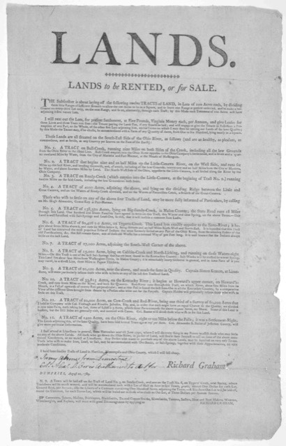
Fighting back wasn’t the Shawnees’ only strategy to maintain access to salt resources. In the summer of 1783, a group of Shawnee hunters convened with three Kentucky settlers south of the Ohio to trade. The Shawnees requested “licker and sault,” and the American traders reportedly secured assurance from a nearby militia commander that traders would soon bring salt to Shawnee towns. Treaties also became another means of negotiation over salt. In the 1803 Treaty of Fort Wayne, Indigenous leaders ceded control over the Grand Saline at the mouth of the Wabash River to the U.S. government. Their price was an annual annuity of 150 bushels of salt that would “be divided among the several tribes in such manner as the general council of the chiefs may determine.”

The few histories of salt in the Ohio Country often start and end with American industry. In these narratives, Shawnees and other Indigenous peoples are treated as peoples without a past or future. But as Susan Sleeper-Smith has recently shown, Indigenous prosperity in the Ohio Country offers critical precedent for the trajectory of American expansion into the region and, more significantly, Indigenous peoples’ ability to retain access to vital spaces, resources, and networks. Indeed, early American salt makers exploited productive precedents established by generations of people who had engaged with salt resources for thousands of years. This deeper history of salt shaped space, relations, and power dynamics during the eighteenth century in ways both explicit and obscure.

As the tumultuous salvation of the Shawnees’ Go-cum-tha and her Wash-et-che reminds us, salt’s ability to invite both creation and destruction to the heart of Shawnee homelands was hardly contradictory and hardly ancient history. That great salt water that drowned and drained the region’s lands long ago remained just as powerful and potent generations later, emerging in the form of brine seeps, mineral springs, and salt licks that helped to orient life across the Ohio Country.


Further Reading

George Bluejacket, “A Story of the Shawanoes,” recorded at Wapaughkonnetta, Ohio (October 29, 1829); trans. and ed. John Allen Rayner (March 1886), via Kansas Memory, https://www.kansasmemory.org/item/210156/.

Stephen Warren, The Worlds the Shawnees Made: Migration and Violence in Early America (Chapel Hill: The University of North Carolina Press, 2014).

Harriette Simpson Arnow, Seedtime on the Cumberland: Life in the Cumberland River Region of Kentucky and Tennessee, 1780-1803 (New York, NY: Macmillan, 1960).

Eric J. Wallace, “Making Salt From an Ancient Ocean Trapped Below the Appalachians,” Atlas Obscura, Jan. 8, 2018.

Honor Sachs, Home Rule: Households, Manhood, and National Expansion on the Eighteenth-Century Kentucky Frontier (New Haven: Yale University Press, 2015), esp. ch. 2.

Ian W. Brown, Salt and the Eastern North American Indian: An Archaeological Study (Cambridge, MA: Harvard Univ. Peabody Museum, 1980).

Thomas D. Clark, “Salt, a Factor in the Settlement of Kentucky,” Filson Historical Society Archives, May 3, 1937.

Paul N. Eubanks and Ian W. Brown, “Certain Trends in Eastern Woodlands Salt Production Technology,” Midcontinental Journal of Archaeology 40, No. 3 (2015).

James L. Murphy, “Above the Salt: Test Excavations at the Scioto Saline, Jackson County, Ohio,” Ohio Archaeologist 54, No. 2 (2004): 38-42

Stanley Hedeen, Big Bone Lick: The Cradle of American Paleontology (Lexington, KY: University Press of Kentucky, 2008).

Kenneth B. Tankersley, Michael R. Waters, and Thomas W. Stafford Jr., “Clovis and the American Mastodon at Big Bone Lick, Kentucky,” American Antiquity 74, No. 3 (2009): 558-67.

Walter Fewkes, John R. Swanton, and William Edward Myer, Forty-Second Annual Report of the Bureau of American Ethnology, 1924-1925 (Washington, DC: Smithsonian Institution, 1925).

John A. Jakle, “The American Bison and the Human Occupation of the Ohio Valley,” Proceedings of the American Philosophical Society 112, No. 4 (1968): 299-305.

Susan Sleeper-Smith, Indigenous Prosperity and American Conquest: Indian Women of the Ohio River Valley, 1690-1792 (Chapel Hill: The University of North Carolina Press, 2018).

Gwynn Henderson, “The Lower Shawnee Town on the Ohio: Sustaining Native Autonomy in an Indian ‘Republic,’” in The Buzzel about Kentuck: Settling the Promise Land, ed. Craig Thompson Friend (Lexington, KY: University Press of Kentucky, 1999), 25-55.

Gwynn Henderson, “Dispelling the Myth: Seventeenth- and Eighteenth-Century Indian Life in Kentucky,” Register of the Kentucky Historical Society 90, No. 1 (1992): 1-25.

James Duvall, ed., Early Documents relating to Mary Ingles and the Escape from Big Bone Lick, (Burlington, KY: Boone County Public Library, 2008).

John Mack Faragher, Daniel Boone: The Life and Legend of an American Pioneer (New York, NY: Henry Holt and Company, 1992).

H. Bogart, Daniel Boone and the Hunters of Kentucky (Philadelphia, PA: J. B. Lippincott and Co., 1881).

Isaac Lippincott, “The Early Salt Trade of the Ohio Valley,” Journal of Political Economy 20, No. 10 (1912): 1029-52.

Robert E. McDowell, “Bullitt’s Lick: The Related Saltworks and Settlement,” Filson Club History Quarterly 30, No. 3 (1956).

John A. Jakle, “Salt on the Ohio Valley Frontier, 1770-1820,” Annals of the Association of American Geographers 59 (Dec. 1969): 687-709.

Reuben Gold Thwaites, Early Wester Travels, 1748-1846, 5 vols. (Cleveland, OH: The A. H. Clark Company, 1904-1907).

Reuben Gold Thwaites and Louise Phelps Kellogg, eds., Documentary History of Dunmore’s War, 1774 (Madison, WI: Democrat Printing Company, 1908).

Reuben Gold Thwaites and Louise Phelps Kellogg, eds., Frontier Defense on the Upper Ohio, 1777-1778, Draper Series vol. 3 (Madison, WI: Wisconsin Historical Society, 1912).

Richard Collins, Collins’ Historical Sketches of Kentucky: History of Kentucky, ed. Lewis Collins, vol. 2 (Covington, KY: Collins & Co., 1874).

Rob Harper, Unsettling the West: Violence and State Building in the Ohio Valley (Philadelphia: University of Pennsylvania Press, 2018).

“Treaty of Fort Wayne,” Kansas Kickapoo Tribe, https://www.ktik-nsn.gov/history/treaties/1803-treaty/.


This article originally appeared in January 2022.


Annabel LaBrecque is a Ph.D. student in the Department of History at University of California, Berkeley. Her work explores interdisciplinary approaches to the significance of salt throughout North American history. She has previously published research on salt and power in the sixteenth-century Lower Mississippi Valley for the Scottish Centre for Global History.