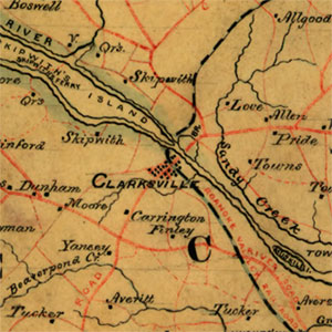
Fig. 8. A relief map showing towns, waterways, roads, geographic features and land owners. “Map of Mecklenburg, Brunswick and Greensville counties, Va.,” ca. 1864 map from the Confederate Engineer Bureau in Richmond, Virginia (Sheet No. 3). General J. F. Gilmer, Chief Engineer. Presented to the Virginia Historical Society by his only daughter, Mrs. J.F. Minis, Savannah, Georgia. Courtesy of the Geography and Map Division, the Library of Congress, Washington, D.C., and the Virginia Historical Society, Richmond, Virginia. To the right is an enlargement of the area around Clarksville; click on map to enlarge full map in a new window.
The ethos of home place that has an identity through


