reviews

Land that Could Become Water: Dreams of Central America in the Era of the Erie Canal

Brockmann’s research and her insightful arguments taught me not only that plenty of knowledge production occurred in Central America before the 1820s but also that this “practical” information was designed to serve locals rather than foreigners.

image_pdfSave to PDFimage_printPrint

In the mid-1820s, Central America was terra incognita to most people in the United States. Closer than California, the isthmus at the center of the hemisphere intrigued many of the era’s merchants, politicians, and more.

Two hundred years later, despite historians’ embrace of the expansiveness of Karin Wulf’s concept of “vast early America,” the history of Central America remains an odd terra incognita for many early U.S. historians. As someone who has spent more than a decade researching the 1820s quest for a Nicaraguan canal, I find this lack of historical curiosity about Central America curious. Why has such a close place been so unknown?

In the mid-1820s, nobody knew what to call the narrow strip of land between the Atlantic and Pacific Oceans that connected North and South America. Imprecise nomenclature did not stop President James Monroe from extending diplomatic recognition to the new nation on August 4, 1824. In two documents written that day, Secretary of State John Quincy Adams referred to the country by different names: “the United Provinces of the Centre of America” and “the Republic of Guatemala.” As in the parlor game of telephone, Adams was imprecisely echoing the language of the new government’s agents. In a letter to the Monroe administration, the first Central American diplomat assigned to Washington, D.C. referred to his nation as: “el Supremo Gobierno de Guatemala o de los Estados Federados del Centro de América.” A State Department employee translated this phrase as providing two alternative names: “the Supreme Government of Guatemala or . . . the Federal States of the Center of America.”

All these names referred to the same place—the territory currently governed by the Mexican State of Chiapas and the modern nations of Guatemala, Honduras, El Salvador, Nicaragua, and Costa Rica. But there was meaning in the different monikers. For three hundred years of Spanish Imperial rule, the region was called the Captaincy General or Kingdom of Guatemala. The word “Guatemala” also applied to the region’s capital city and the dominant province within the Kingdom. Avoiding Guatemala’s linguistic confusion, names like the United Provinces of Central America described the region’s new governmental structure, and its prime place on the globe. 

Figure 1: Central America lies near the center of this 1815 world map. Mathew Carey, Carey’s General Atlas, Improved and Enlarged: Being a Collection of Maps of the World and Quarters, Their Principal Empires, Kingdoms, &c. (Philadelphia: M. Carey, 1815). Courtesy of the American Antiquarian Society, Massachusetts.

Whatever it was called, Central America possessed a unique geographical position that had attracted the attention of merchants, politicians, and men of science for three centuries. Cartographically, it was often located near the middle of world maps, literally at the center of the Americas. On some hemispheric maps of the era, the land linking the continents tapered so severely that the isthmus almost disappeared. Squint and it vanished. 

Figure 2: The Central American Isthmus appears so narrow in this 1827 hemispheric map that it almost vanishes. Anthony Finley, A New General Atlas, Comprising a Complete Set of Maps, representing the Grand Divisions of the Globe, Together with the several Empires, Kingdoms and States in the World; Compiled from the Best Authorities, and corrected by the Most Recent Discoveries, Philadelphia, 1827. Public domain, via Wikimedia Commons.

That was the point. Here was land that could become water. To some outsiders and regional elites, the narrowness of the terrain coupled with the existence of rivers and lakes turned isthmian land into aqueous treasure. Spanish imperialists recognized this value immediately. After all, Christopher Columbus’s voyages—which led to centuries of Spanish colonialism in the Americas—had been motivated by the search for a fast sailing route between Europe and Asia. As early as the sixteenth century and continuing until independence in the early 1820s, Spanish cartographers emphasized cities, coasts, lakes, and rivers on otherwise nearly empty maps of the region. Despite its global imperialism and interest in existing Central American waters, the Spanish Empire never constructed an interoceanic waterway.

The end of Spanish rule of the region coincided with a spike in U.S. interest in canal construction. In the 1820s, canal projects sprung up all over the U.S. Inspired by the Erie Canal’s linking of the Mississippi Valley to the Atlantic seaboard, some men of business and politics expanded their canal dreams beyond U.S. national boundaries.

No longer constrained by the limits of natural waterways, canal dreamers of the 1820s believed they could apply the latest scientific knowledge and engineering techniques to “improve” nature anywhere. A deep waterway that connected the Atlantic and Pacific Oceans appealed to merchants looking to increase U.S. trade with China, India, and the western coast of the Americas. Having overhunted the Atlantic populations of marine mammals for their blubber and oil, New England whalers envisioned shortening their lengthy voyages to find surviving Pacific pods. And U.S. politicians eyed a shortcut to sovereignty over the Oregon Territory and other desirable west coast lands. The project of constructing Columbus’s interoceanic water route, they believed, would transform world history, and prove very profitable.

Perhaps the most popular interoceanic canal plan of the era involved the reengineering of the same Central American bodies of water that had captured Spanish cartographic attention for three centuries. Just north of the land’s narrowest point, Lake Nicaragua (or Lago Cocibolca) occupies about half the width of the isthmus. This large freshwater lake drains to the Caribbean Sea through the winding eastbound San Juan River. In the other direction, the enormous Pacific Ocean looms only about twelve miles away from the lake’s western edge. The combination of so much water and such little landmass offered what many interpreted as the ideal location for a canal. For elites in Europe and North America, Central America became an X on a hemispheric treasure map.

But the precise terrain for the potential canal—let alone the history, politics, demographics, hydrology, geology, and biology of Central America—remained an unknown variable in determining the waterway’s physical and financial feasibility. The more foreigners coveted Central America’s treasure, the more they wanted to know about the region. What other assets did the unknown isthmus hide? Did it harbor silver mines like its northern neighbor Mexico, or nurture medicinal herbs like the quinine of Peru to the south? More than just the nation’s name proved mysterious.

In his instructions to the first U.S. diplomatic agent assigned to Guatemala City, Secretary Adams conveyed the U.S. government’s lack of knowledge of the region: “of all the countries of the Southern Continent, it is that with which we have, hitherto, the fewest relations, and concerning which we have the least information.” Determined to remedy this lack of data, Adams ordered, “The first and constant object of your attention . . . will be to obtain and to communicate to this Department . . . information, as well respecting the physical condition of the country, as the moral and political condition of its inhabitants.”

Retrieving this information proved deadly. The first recipient of the instructions died in Norfolk, Virginia, before ever departing for Guatemala City. The second man died mid-journey in the Florida Keys. When the third diplomat to receive this order finally arrived in Central America, he blamed Spain for consigning “this fair portion of the earth to oblivion” and for keeping the region “shrouded from the eye of science.” No data could be obtained; it had to be made.

Some Central American leaders wanted the new nation to support the scientific work that would reveal the region’s value to the world. “To know if the opening of the Canal is possible,” one Guatemalan representative argued on the floor of the national Congress, “it is necessary to survey all the land through which the canal line must pass from the north coast to the south coast: it is necessary to do leveling, to determine heights and set degrees: it is necessary to establish the general map of the State, and the special one of the San Juan River, of Lake Nicaragua, and the dividing land between it and the Pacific Sea.” He confirmed, “None of this has been executed so far with the necessary accuracy. No leveling has been done: no heights have been calculated: no positions have been determined. We do not yet have maps, plans, or exact sketches.”

Figure 3: The San Juan River has been widened, straightened, and shortened in this 1826 copy of a colonial map of Central America. Empty aside from undefined rivers, Eastern Nicaragua is labeled “Yndyos Mosquytos.” Aaron Arrowsmith, Map of Guatemala: Reduced from the Survey in the Archives of that Country, 1826 (London: Published by A. Arrowsmith, to His Majesty, 1826) Map, https://www.loc.gov/item/2004629011/, Library of Congress, Geography and Map Division.

True, Central America might not have the kinds of maps, plans, or surveys that Adams or this legislator would have liked canal engineers to evaluate, but Central America was not quite “shrouded” from science. In her fascinating new book, The Science of Useful Nature in Central America: Landscapes, Networks and Practical Enlightenment, 1784-1838 (Cambridge University Press, 2020), Sophie Brockmann offers significant evidence that Central America had a long tradition of producing useful knowledge. Brockmann argues that, from the late colonial period through the first decade of independence, Spanish officials and elite Central Americans pursued a “practical Enlightenment that would offer prosperity by applying scientific knowledge to the management of landscapes” (1). Although these efforts “did not succeed in completely transforming Central America’s economic fortunes,” Brockmann insists that “we should take seriously many scattered short reports from across the kingdom, mainly in matters of agriculture or natural history, sometimes infrastructure, geography, or medicine, which reported attempts at improvement, progress, and pride in members’ achievements” (7).

The kinds of data that could lead to Central American canal construction were precisely the forms of “practical” knowledge sought first in the eighteenth century by closed Spanish administrative circles and later by a broadening swath of the population. With the 1790s foundation of the Real Sociedad Económica de Amantes de la Patria de Guatemala (referred to by Brockmann as the Economic Society) and its weekly newspaper the Gazeta de Guatemala, Central American merchants, government officials, priests, and other elites began to publicly circulate their own knowledge about botany, demography, geology, climate, geography, and more.

But this data was often not rendered legible to the outside world. Prioritizing local use over European standards, the Gazeta rejected Latin taxonomies in favor of local terms for plants and animals. As Brockmann explains, the use of Indigenous names “might make it easier to identify plants in the future with the help of local informants” (96). This made the Central American case studies of rice, red-dye-producing cochineal beetles, and the medically useful herb rox iyuin umùl (a Kakchiquel term) less universally comparable but more actionable in a system dependent upon the knowledge and labor of Indigenous people who did not necessarily speak Spanish (let alone Latin). The rejection of European scientific standardization coupled with the occasional royal shutdowns of the society and its press obscured the knowledge production of the region to outsiders. As Brockman concludes, this meant that information produced in the region became distinctively and often exclusively Central American.

Figure 4: Sophie Brockmann, The Science of Useful Nature in Central America: Landscapes, Networks and Practical Enlightenment, 1784-1838 (Cambridge: Cambridge University Press, 2020).

The priority of producing locally useful knowledge extended not only to agricultural experimentation but also to geography. Although Spanish administrators participated in “a lively geographical tradition,” the documentation they produced was cloistered in Spanish archives (121). Trying to fill what they perceived to be a “geographical vacuum,” the Economic Society began gathering geographical information in the 1790s (121). Society members, however, emphasized prose description over mapmaking and local use over universal norms. To make its articles accessible to its readers, the Gazeta renounced the use of “mathematical abstraction”—latitude and longitude—in geographical descriptions (123). This meant Central American geographical knowledge could not be easily mapped onto the globe.

By the era of independence, the society and the Gazeta had been producing and circulating geographical descriptions for decades, but the prioritization of local usefulness over adopting universal methods made the existing data inscrutable to outsiders. As the new nation’s political and economic leaders sought investment from foreign capitalists, “cartographic representations were in short supply” and “existing maps of Guatemala gained a rather frosty international reception” (222).

Quenching this geographical demand would not be easy. Colonial era attempts suggested some of the issues that continued after independence. In the 1790s, Nicaraguan elites sought precise maps of the potential canal route, but their proposal was rejected by Guatemalan merchants who did not want their trade monopoly challenged. These sorts of interregional rivalries continued after independence, and by the 1830s, contributed to what Thomas L. Karnes described as the region’s “failure of union.”

But even if the Guatemalans supported the charting of a Nicaraguan canal in the 1790s, crown officials likely would have refused permission for the project because Spanish officials feared conflict with the Indigenous residents of the proposed route (150-51). Although the canal route was technically in the province of Nicaragua, much of the eastern side of the isthmus—including the San Juan River—had never been fully conquered by the Spanish.

Often referred to by their British allies as the “Mosquito Indians,” several Indigenous nations (including Miskitú, Mayangna, and Rama communities) controlled this territory. While elites in the cities of Léon, Granada, and Managua may have advocated for the construction of a canal, they did not know the land and water as well as the people who inhabited and controlled access to the proposed route. This meant that the creation of scientific information—the kind of topographical calculations, geological surveys, and climate studies necessary for engineering a canal—demanded not only the deployment of trained scientists to the region but also negotiation with people who quite understandably might not want engineers planning how to turn their land into water.

Throughout Central America, what looked like uncharted yet potentially fertile “wilderness” to European-descended reformers remained, in their view, “the precious secret of the Indian population” (159). Brockmann explores perceptions of Indigenous people’s “secret knowledge of the countryside” primarily in terms of “roads and paths” (207).  Nonetheless, the Indigenous men and women who inhabited the would-be canal route surely possessed riverine and lacustrine knowledge even though they did not record this information in the forms most useful to Madrid, Washington, or Guatemala City. Why would they? Miskitú sovereignty over the region had not been recognized by the Spanish or by the new country forming in Guatemala City. The Federal States of Central America did not include the State of Miskitú; the new nation hid vast Indigenous territory within the provinces of Nicaragua and Honduras. As this suggests, empty spaces on Central American maps often reflected not a vacuum of knowledge but purposefully hidden politics.

Figure 5: Entitled “Plano Ideal,” this 1823 map visualized the canal dreams of leaders in Granada, Nicaragua. Several hand-drawn copies of this idealized canal route circulated in Guatemala, Washington, D.C., and London. “Plano Ideal – Proposed Communication between Pacific Ocean, Lake Nicaragua, Central America, by canal, 2/1823” (77-CWMF-AMA-8), North America, Civil Works Map File, 1818-1947, RG 77: Records of the Office of the Chief of Engineers, 1789-1999, National Archives and Records Administration, College Park, MD, https://catalog.archives.gov/id/169050696.

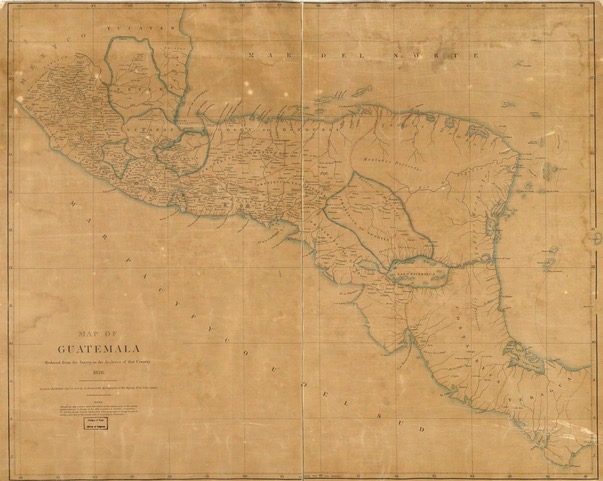
And as the imprecision of the country’s name at its moment of U.S. recognition suggests, the politics of Central America were unstable in the mid-1820s. Later in the decade and into the 1830s, as civil war destroyed the Central American union, foreigners mined the colonial archives and traveled the countryside producing and circulating scientific data that conformed to European conventions and would be more useful to foreign capitalists than local farmers. Science in Central America became less provincial just as the provinces became their own nations with the familiar names we know today.

Foreign canal dreamers from the U.S., Netherlands, France, and Britain would employ this scientific knowledge to promote interoceanic waterway projects in the Republic of Nicaragua throughout the nineteenth century. In the early twenty-first century, more than a hundred years after the opening of the Panama Canal, interest in constructing a waterway through Nicaragua persisted. Reversing the direction but not the dream, the most recent canal contractor sought a waterway to link his nation, China, with its Atlantic trade partners.

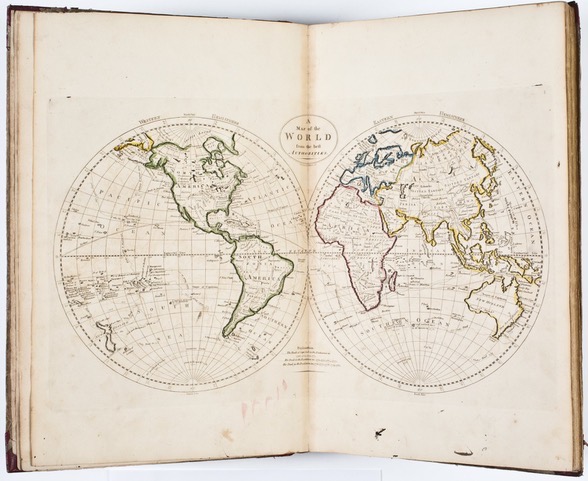
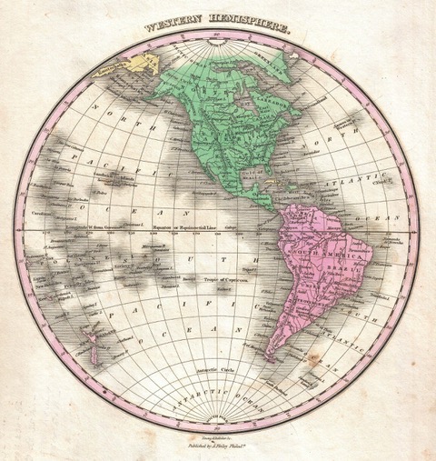
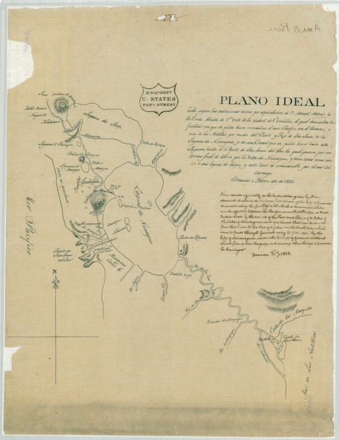
Plans for a Nicaraguan waterway have a long history, but there’s something special about the 1820s quest for a Central American canal. Without access to the types of scientific data that informed later proposals, the would-be canal constructors of this era blindly and optimistically envisioned the creation of a world-changing waterway. They proceeded despite their ignorance. In place of information, they relied on their imaginations. Dreams substituted for data. Ultimately, their canal dreams proved impractical, but quite influential. The idea that an interoceanic waterway could and should be constructed shaped international diplomacy, launched scientific investigations, and contributed to speculative enterprises on both sides of the Atlantic.

Unknown to them, the region was not quite as mysterious to everyone. Before I read Brockmann’s book, I was inclined to agree with Adams and the authors of my other primary sources who argued that the isthmus was an obscure place that was scientifically unexplored. Brockmann’s research and her insightful arguments taught me not only that plenty of knowledge production occurred in Central America before the 1820s but also that this “practical” information was designed to serve locals rather than foreigners. Applying these conclusions to my own research, I realized that the people who best knew the isthmian land most valued by the rest of the world likely protected their knowledge. The inhabitants of Central America’s aqueous treasure might want to keep their lands a mystery to keep their lands.

The early nineteenth-century systems of knowledge creation and dissemination that served Central American locals rather than foreigners provides an answer to the question of why an intriguing place central to the Americas and a thousand miles closer to Washington, D.C. than San Francisco was so unknown in the early U.S. republic. Moreover, because this terra was intentionally incognita, its significance to U.S. history has also been obfuscated. The primary sources claimed ignorance, and the secondary sources generally looked no further.

But what can we know from what early Americans didn’t know? It is hard for historians to see the significance of something unknown and unbuilt. We tend to truck less in undoable dreams and more in the definitively done. The Panama Canal incontestably made history, but could history also be made of imagined waterways? I think so. If we squint, we can see treasure hidden in the absence of firm historical ground.

Further Reading

Sophie Brockmann’s The Science of Useful Nature in Central America: Landscapes, Networks and Practical Enlightenment, 1784-1838 (Cambridge: Cambridge University Press, 2020) is a thorough investigation of early Central American science. For Central American political history in the era of independence, see Jordanna Dym’s From Sovereign Villages to National States: City, State, and Federation in Central America, 1759-1839 (Albuquerque: University of New Mexico Press, 2006). For the collapse of the Central American republic, see Thomas L. Karnes, The Failure of Union: Central America, 1824-1960 (Chapel Hill: University of North Carolina Press, 1961). The older historical literature on the Indigenous nations of Eastern Nicaragua often focuses on British influence in the region. For example, see Craig L. Dozier, Nicaragua’s Mosquito Shore: The Years of British and American Presence (Tuscaloosa: University of Alabama Press, 1985). Recent journal articles by Damian Clavel, Matthew P. Dziennik, and Caroline A. Williams center the Miskitú in the region’s history. For a current map of the homelands of Miskitú, Rama, Mayangna, and other Indigenous communities, see https://native-land.ca/. My thinking on the cartography of Central America owes debts to many of the essays in Jordana Dym and Karl Offen, eds., Mapping Latin America: A Cartographic Reader (Chicago: University of Chicago Press, 2011); I am especially drawing on essays by Dym, Offen, Matthew Restall, W. George Lovell, and Christopher H. Lutz. For U.S. hemispheric diplomacy and popular perceptions of the new Spanish American nations, see James E. Lewis, Jr., The American Union and the Problem of Neighborhood: The United States and the Collapse of the Spanish Empire, 1783-1829 (University of North Carolina Press, 1998); and Caitlin Fitz, Our Sister Republics: The United States in an Age of American Revolutions (New York: Liveright, 2016).

The quotations from State Department documents can be found in various microfilms at the National Archive at College Park, Maryland. John Quincy Adams’s narrative account of Central American Recognition can be found in the Massachusetts Historical Society’s John Quincy Adams Digital Diary for August 4, 1824. The Central American legislator who argued for canal data was later the president of the post-independence Economic Society; his speech can be found in José del Valle and Jorge del Valle Matheu, eds., Obras de José Cecilio del Valle (Guatemala, 1929). I am grateful to James Irving for his eloquent Spanish to English translations and to Michael Dube, Julia Rodriguez, Joshua Greenberg, Jordan Taylor, and an anonymous Commonplace editorial board member for their insightful suggestions.


This article originally appeared in April 2022.


Jessica Lepler is associate professor of history at the University of New Hampshire. Her first book, The Many Panics of 1837: People, Politics, and the Creation of a Transatlantic Financial Crisis (Cambridge University Press, 2013), won the James H. Broussard Best First Book Prize from the Society for Historians of the Early American Republic. She is currently writing a book on the 1820s quest for a Nicaraguan interoceanic canal.

image_pdfSave to PDFimage_printPrint