Twenty-five years ago, when I organized a college history course on the American city, it started at the beginning (in the seventeenth century) and finished at the end (in the twentieth century). That was, after all, the story line—from the beginning to the end—in the history courses that I had experienced (and mostly relished) as a student. When I teach the same course today, at Lake Forest College, the narrative is more complicated. I begin with the conclusion, circa 2000, before moving backwards chronologically to the seventeenth century. And it ends where it began, in the present!
Playful? Certainly! How a syllabus is devised, and more importantly how its narrative is recast over the years, should result from an imaginative—playful—approach to the art and craft of teaching. Why did I depart from convention in this case? Students chided me (gently), via casual conversation and (mostly friendly) comments written in their end-of-course evaluations, that they wished their syllabus allocated more space for contemporary American cities. Ultimately I deduced that many students enrolled because of their interest in cities as they experience them today. My objective was to historically frame their experiences with contemporary cities. Hence my delicate task: nurturing romance between then and now.
History 263: American Cities meets over a fifteen-week semester, a total of forty-five hourly sessions. The tempo is fast, between allegro and vivace. My purpose—inspired by Eric E. Lampard, an influential urban historian—is the construction of a global scaffold for the urban history of the United States encompassing the nineteenth and twentieth centuries. The point of departure is the rapidly accelerated pace of urbanization during the nineteenth century. The very first session is called “A Century of Cities.” We sketch—but do not plumb—how urbanization exercised a dynamic, transforming effect, spawned by England’s Industrial Revolution. Ingraining Manchester in my students’ historical sensibilities, I portray it—visually and in words—as the shock city of the modern world, circa 1840 (that almost noir phrase devised by Asa Briggs, an English social historian). Then we travel across the Atlantic Ocean, hastily tracing the unfolding of urban networks in the United States. Chicago, in the 1890s (the world’s fastest growing city in the final quarter of the nineteenth century, claims Briggs), is the next shock city. In the middle of the twentieth century, Los Angeles assumed the Briggs artifice as a consequence of its extraordinary ascent from regional center for production and distribution into a global city lately characterized by David Rieff as the capital of the third world. (When its population first eclipsed one hundred thousand in 1900, Los Angeles ranked thirty-sixth in population among the nation’s cities, ahead of Memphis but behind Omaha!)

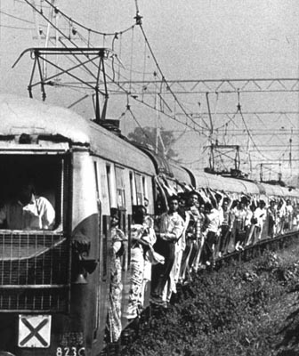
After the fifth class session we have traversed the entirety of the nineteenth and twentieth centuries. Multiple things have happened as we march, double step, toward the present. First, the students develop a vocabulary of (often contestable) terms (e.g., edge city, dual metropolis, sun belt, new federalism, technoburb, new urbanism, underclass, hyperpauperization, spatial mismatch). Secondly, I strive to expand their geographic sensibilities (and my own) by studying—still on the surface—the causes and circumstances of urban growth in its most extreme form during the fourth quarter of the twentieth century. Particular attention is given to nonwestern cities (e.g., Bombay, Ho Chi Minh City, Jakarta, and Manila.) In so doing, the students visualize the stark yet memorable work of photographer Sebastiâo Salgado, whom I myself stumbled upon in a recent exhibit organized by the International Center of Photography in New York City. We also examine population data, compiled by the United Nations, on the geographic distribution of the world’s largest cities. Finally, each student pursues a quantitative research project framed in the final quarter of the twentieth century. Focused on Chicago, it is tied to their reading of William Julius Wilson’s When Work Disappears: The World of the New Urban Poor (New York, 1996).
At this point History 263 reverts back three centuries in a kind of Rip Van Winkle in reverse! Freshly awakened, students inhabit the seventeenth century, not the twenty-first. Now the class studies the coastline cities from Boston to Charleston—the largest population concentration in 1700 was Boston’s (6,700)—to explore the roots as well as the manifestations of the earliest urbanization in British North America.
Luckily, my students are not asleep. Rather, I find them alert for comprehending—even appreciating—their subject matter. (Although quite the opposite was true when I taught the course from chronological beginning to end; then students frequently lamented that they were being compelled to study cities at a remove of 350 years.) By the time we travel to the eighteenth century, we are fastening upon the ingredients basic to the history of urban development (e.g., market economies, transportation networks, spatial organization and differentiation, demography and cultures, gender, enterprise, infrastructure, governance, public services, health, and safety, and westward expansion.) Special emphasis is given over to the lack of provision for cities in the federal system created by the Constitution, rendering their status in the nation-state perpetually unresolved.
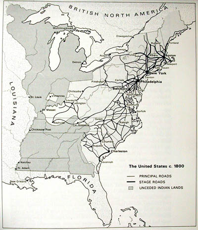
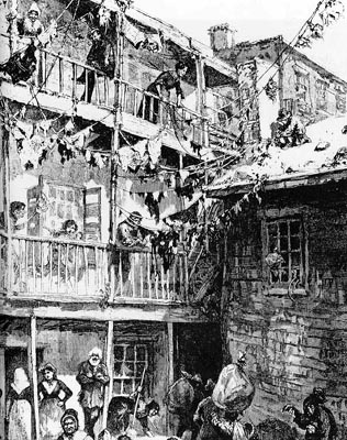
Entering into the nineteenth century, the narrative approaches a significant intersection: the juncture where students entered this course four weeks earlier. Over five weeks I immerse them (again) in the nineteenth century and the American version of the Industrial Revolution. We view cities, both close up and from a distance, by occupying sundry vantage points from one session to another. On a microcosmic level, we study the intricacies of daily urban life as we learn about how people lived, worked, and organized themselves in a century of momentous change. Charles E. Rosenberg’s The Cholera Years, The United States in 1832, 1849, and 1866 (Chicago, 1987), with a new afterward, lends itself admirably to this, no more so than in the session given over to “Smelling the Pre-Civil War City.” Two weeks later, nearing the close of the nineteenth century, we read the Bedford edition of How the Other Half Lives (New York, 1996), wisely edited by Daniel Leviatan; while Jacob Riis appears prosaic in the eyes of some teachers of undergraduates, for me his (contestable) images and his life story as well their ramifications constitute another teachable moment. On a macro level, our scope encompasses the proliferating systems and networks that unfolded across the expansive geographic plane of the nation-state. Starting with the Gallatin Plan for internal improvements (1808), too much neglected in today’s classrooms, we sequentially learn about turnpikes, steam boats, the Erie Canal, and successive innovations in rail transport as well as communications over the span of the century.
Much of this, I gladly confide, derives from my lifelong inclination for historical geography. I can ascribe it to an inspired and beloved third-grade teacher. Meta Wentink at Public School #1 in Clifton, New Jersey, some fifty years ago, taught us about Mediterranean civilizations. (Phoenicia was lavender on her wonderful wall maps.) Much more recently its impulse is the cultural geographer D. W. Meinig, whose scholarship employs artful cartography for a powerful geographic narration of American history. (Meinig’s oeuvre lends itself to constructing American history courses in any number of configurations. His multivolume The Shaping of America is a frequently consulted staple in my personal library. The fourth and concluding volume is awaited, avidly.)
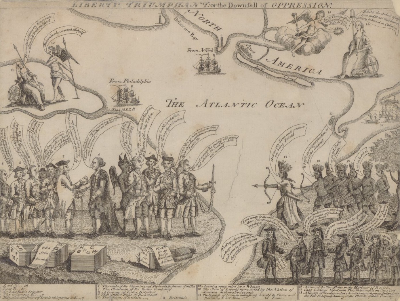
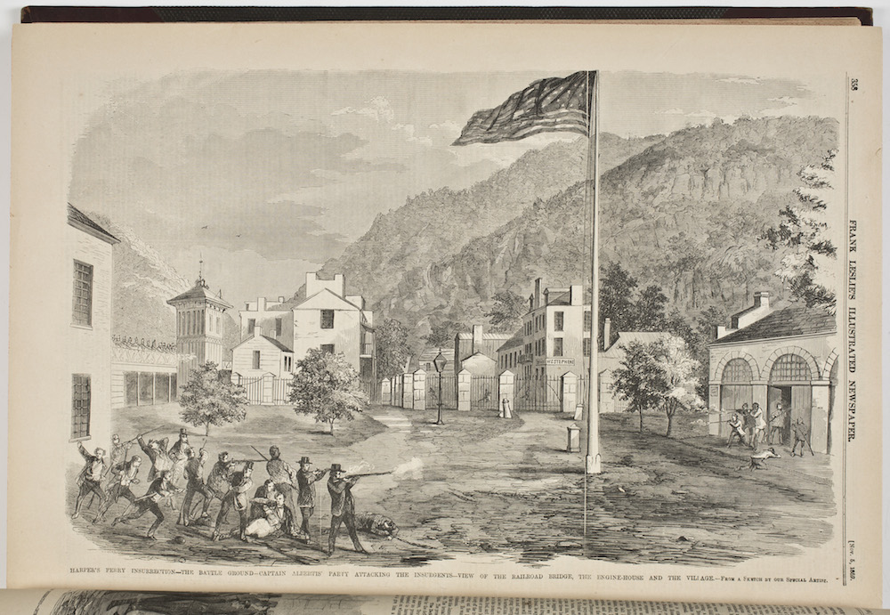
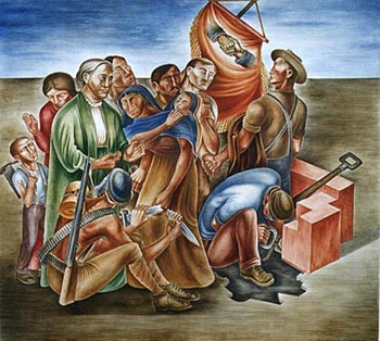
The nation-state, referred to earlier as indispensable to History 263, amplifies its narrative by underscoring that the urban and the political must be considered interdependently. In so doing it reveals dramatic exercises of public as well as private authority. In some cases—none more so than the New York City Draft Riot of 1863—it illustrates classic examples of interaction between local, state, and federal entities. We study a number of other circumstances: the inability of municipal governments to address the consequences of rapid urbanization; occasional collapses of civil order in cities during the three decades preceding 1863; and collisions of labor and capital during the last third of the nineteenth century. Like so many instructors, I invoke Jane Addams’s Twenty Years at Hull-House, selecting (from among several options) the exceptional Bedford edition assembled by Victoria Bissell Brown. Addams—in my eyes, must reading for undergraduates regardless of concentration or aspiration—fosters recognition of the radically changed sociological landscape in American cities and the much-needed reordering of the nation-state as the nineteenth and twentieth centuries converged.
The twentieth century is the destination most coveted by my students and in its current iteration History 263 seemingly satisfies their aspiration. Reaching this point in the eleventh week of the semester, our attention is given over to a sequence of topically organized, often in-depth explorations that culminate in the present day. Focal points include race, with particular emphasis on Chicago; politics, especially the Chicago regimes of Anton J. Cermak, Richard J. Daley, Harold Washington, and Richard M. Daley; the Great Depression, focusing upon its large scale redefinition of the nation-state; interregional demographic shifts, especially to the sun belt; transportation advances, most notably motorized vehicles; technological innovations, with emphasis on aeronautics, climate controlled environments, and global communications; and suburbanization.
And to fortify this coverage of twentieth-century urban America, I punctuate the culmination of History 263 with a field study and a research assignment. Students are required to participate in a day-long (9:00 A.M. to 5:00 P.M.) field study of Chicago neighborhoods that I conduct on a Saturday as the end of the semester approaches. I once read—and accept as fact until convinced otherwise—that as Woodrow Wilson wrote the dissertation at Johns Hopkins University that became Congressional Government (1885) not once did he travel from Baltimore to observe the deliberations of the national legislature. Recounting this to my students, I advance the proposition that Chicago (thirty miles to the south) comprises our geographically extended classroom. (The James S. Kemper Foundation and the Andrew W. Mellon Foundation underwrite Chicago-centered curricular initiatives at Lake Forest College.) Traveling by chartered coach, I construct for them (with gratitude to Rhys Isaacs for the concept) a series of vivid glimpses that includes four walking tours (a neighborhood of single-family homes, dating to the 1920s, on the northwest side; Richard J. Daley’s neighborhood of Bridgeport; the Prairie Avenue Historic District; and the Gold Coast). What they discover is the dual metropolis (decay amid glitter, despair amid opportunity). We also make a brief visit to the Chicago Historical Society.
The second research assignment is framed by the students’ compulsion to immerse themselves in the late twentieth century. Ostensibly fixed in the final twenty years of the century, this project involves a storehouse of statistical data that the students must extract from a census report available on the Internet that analyzes the nation’s hundred largest cities between 1790 and 1990. Each student examines a specific city, fulfilling several goals: calculate as well as analyze statistical data for the assigned city plus its metropolitan region, its state, and its census region; construct well-designed statistical tables, ideally using Excel; access, scan, and properly document maps and photographs for integration into the text; rely upon print sources in writing a historically informed interpretation; integrate D. W. Meinig’s The Shaping of America into the analysis; and assess their city and its metropolis, comparing it both regionally and nationally between 1980 and 2000.
When I encounter former students, whether six months or six years hence, they occasionally offer me their recollections of History 263. Frequently cited aspects of the course include: Manchester, England (which more than a few eventually travel to as a result of this course); the photography of Salgado and Riis; our session about urban smells; the transformations wrought by the Erie Canal on the nation’s geographic organization; the compulsion of Americans to own a single-family home; and our Chicago neighborhoods field study. Students mention as well the images frequently integrated into almost every class session: hundreds of slides (including many maps), online visual resources, and occasional clips of film. (None of the imagery surpasses the Ric Burns rendition of the New York City Draft Riot of 1863, produced for New York: A Documentary Film [1999].) I also hope that my students possess an inventory of women and men (e.g., Willis Carrier, DeWitt Clinton, Oscar DePriest, Jane Jacobs, Florence Kelley, Robert Koch, Francis Cabot Lowell, Mary E. McDowell, Mary Kingsbury Simkovitch, Frank Julian Sprague, Mary Ovington White, and Kemmons Wilson) who stand apart from the mainstays that dominate American history survey courses.
At the semester’s conclusion, I would like to believe, my students’ early present-mindedness is receding. I am convinced that they respond warmly to the complicated narrative that started their course at the conclusion, circa 2000, before suddenly reverting to the seventeenth century. Perhaps their fixation on present-day concerns has shifted as a consequence of their newly acquired and richly fortified historical sensibilities. This is one benchmark of liberal learning, even if undergraduates do not yet grasp it firmly. Encouraged by my students’ enthusiasm, I persevere in nurturing romance between then and now.
Further reading:
A recent version of the syllabus for History 263: American Cities is available for consultation online. Elemental to this course’s architecture (though not to be confused with its assigned reading, which is available in the online syllabus) are Adna Ferrin Weber, The Growth of Cities in the Nineteenth Century: A Study in Statistics (New York, 1899); Asa Briggs, Victorian Cities, with forward by Andrew Lees and Lynn Hollen Lees (Berkeley, 1993); Eric E. Lampard, “The Urbanizing World,” in H. J. Dyos & Michael Wolff, eds., The Victorian City: Images and Realities, 2 vols. (London, 1973), 1:3-58; D. W. Meinig, The Shaping of America, A Geographical Perspective on 500 Years of History, 3 vols. to date (New Haven, 1986, 1993, and 1998); and Eric H. Monkkonen, America Becomes Urban, The Development of U.S. Cities and Towns, 1780-1980 (Berkeley, 1988). An abundant source of statistical data (e.g., housing, traffic, energy, consumer products) that I rely upon is Theodore Caplow et al., The First Measured Century, An Illustrated Guide to Trends in America, 1900-2000 (Washington, D.C., 2001). Regarding Sebastiâo Salgado, I draw upon his book Migrations, Humanity in Transition (New York, 2000); assessing Salgado is Michael Kimmelman, New York Times, July 13, 2001, B27.
This article originally appeared in issue 3.4 (July, 2003).
Michael H. Ebner is the A.B. Dick Professor of History at Lake Forest College and the author of Creating Chicago’s North Shore: A Suburban History (Chicago, 1988).