Few of us who teach early American history can be unfamiliar with the monumental transatlantic slave trade database. Research on this scale is hard to imagine, most especially at the outset of such a daunting project, and also at the conclusion when one examines the results. It is based upon the work of dozens of scholars, made possible by a series of large research grants (from the National Endowment for the Humanities, Britain’s Arts and Humanities Research Board, the W.E.B. DuBois Institute at Harvard, the Mellon Foundation, and Emory University), and it exists only because a small group of inspired scholars were able to see beyond dusty ledgers and records books in such libraries as the National Archives in Kew, and imagine the potential of the information on the pages before them.
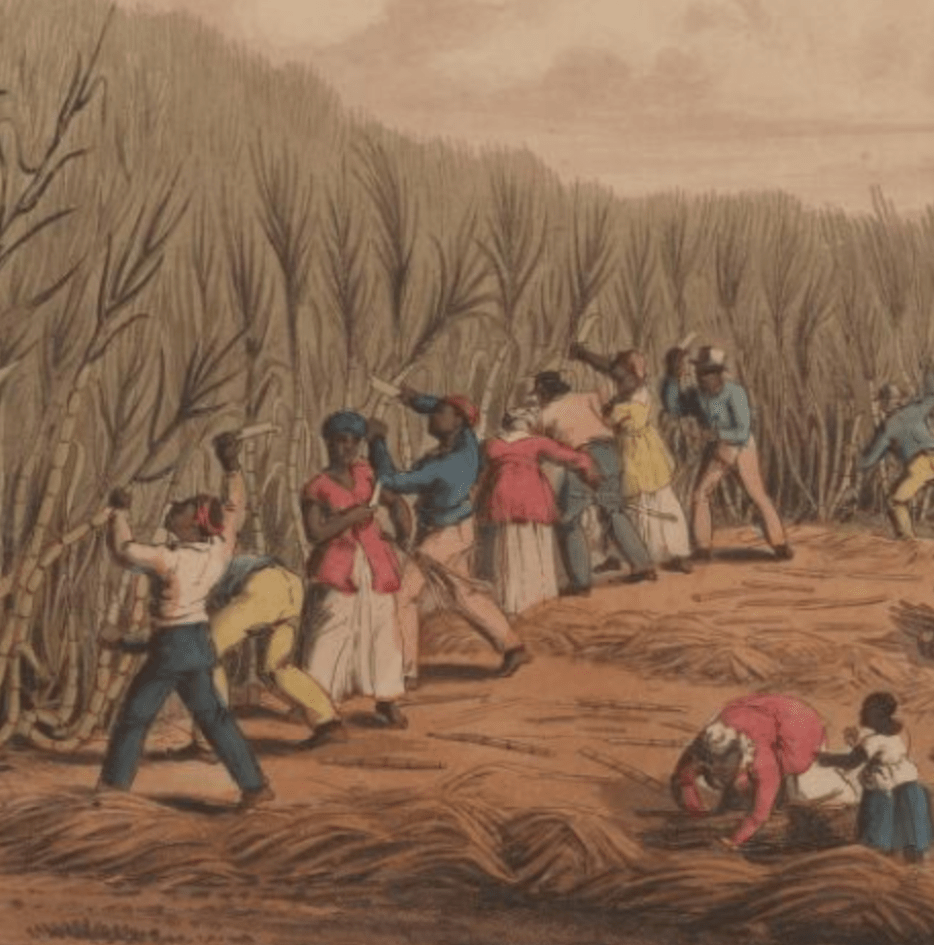
The physical beauty of this book seems at odds with the brutality that it records, the full scale and savagery of the transatlantic slave trade reduced to attractive cartography.
The transatlantic slave trade database is founded upon one of the greatest collective historical research efforts of our age. Beginning with works such as Philip Curtin’s The Atlantic Slave Trade: A Census(1969), a widely disbursed group of scholars has spent almost half a century collecting and coding the records of the transatlantic slave voyages that brought tens of millions of Africans to the New World. David Eltis, Stephen Behrendt and David Richardson played leading roles in amalgamating this data, and then producing software that would make it accessible to students and researchers across the world. The CD-ROM was published in 1999, with details of some 27,233 slaving voyages. Although a remarkable achievement, the creators of this resource were already at work seeking to remedy its deficiencies. Voyages to Latin America were seriously under-represented, and new data from Spain, Portugal, and indeed all of the slave-trading nations continued to accumulate, much of it donated by individual scholars rather than grant-funded researchers associated with the project. Launched in 2009, Voyages: The Transatlantic Slave Trade Database (www.slavevoyages.org) is an online, freely available database encompassing records of almost 35,000 slaving voyages to the Americas.
I am humbled by this database, by the scholarly imagination that inspired it, by the scale of the work involved, and by the ways in which it substantiates one of the greatest human tragedies in modern history. I am also daunted by it. I bought the CD-ROM soon after it was issued, loaded it on my computer and perused the manual, but was never quite sure how best to employ it, either in teaching or research. I have been somewhat more adventurous with the online database, and I have begun to use some of my own calculations in research and publications. Yet it continues to overwhelm me. There is simply so much information, so many different kinds of information: ship construction, the recorded names of the enslaved, the ethnicity of ships’ captains and crews, the prevalence of ship-board rebellions, mortality rates on the Middle Passage, African ethnicity—all these and much, much more can be found in the database. Where does one begin?
One begins with this book. Already it has received numerous prizes, including the Anisfield-Wolf Award: previously won by Dr. Martin Luther King Jr., this prize honors written works that contribute to the understanding of race and human culture. At first glance, the Atlas of the Transatlantic Slave Trade appears to be a coffee table book, lavishly illustrated with nearly two hundred maps and many contemporary engravings and paintings, virtually all of them in full color. The physical beauty of this book seems at odds with the brutality that it records, the full scale and savagery of the transatlantic slave trade reduced to attractive cartography. But the maps work, and even the most casual browser is likely to be astounded by the impressionistic power of these representations to inform one’s understanding of the scale of this forced migration. For me, this book has been invaluable in helping me to understand the entire database, and all that it contains.
The authors have more data at their disposal than historians a generation ago could imagine, and they believe that the database of just under 35,000 documented slave voyages constitute just over 80 percent of all of the slaving voyages that set out for Africa. Often the data is incomplete: the intended destination of a slaving voyage may be recorded, but whether or not it arrived there-or anywhere else-may not be known. The number of slaves purchased and loaded onto a ship in West Africa may be known, but the number who survived the voyage and stepped ashore on the other side of the ocean may not. Based on their growing knowledge of the nefarious trade, the authors have added a dimension to the online database that was not present in the original CD-ROM, including their highly informed calculations of the data that is missing from extant records, but also compiling a new function that seeks to estimate the contours and character of the entire transatlantic slave trade, including the 20 percent of voyages for which no records survive.
The maps and the calculations included in the book are based on the database as it existed one year before it went online, comprising some 34,934 voyages. Surviving data for these voyages varies widely, with complete and detailed records for some and less information for others. In some cases we do not know, for example, all the ports of call for all of these voyages (both in Africa, taking on slaves, and in the New World where the enslaved disembarked). In other cases we do not know how many slaves were on board, or we might not have information about survival rates. Using the patterns that have emerged in the huge amount of surviving data, the project authors have inferred places and imputed numbers, filling in the gaps in the records. A major gap remained, however, as the authors considered the question of what proportion of the total number of transatlantic slaving voyages is reflected in the records that have survived. The answer to this question is vital in any attempt to come to grips with the overall scale of the trade. The authors have been very creative in testing the data they have accumulated: for example, the summaries of French captains’ reports of having spotted other French slave ships provided a random sampling of such voyages, and the authors concluded that over 95 percent of the ships mentioned in these reports appear in the database.
As new datasets appear and are processed, fewer and fewer previously unknown voyages have been discovered. Slave-trading voyages in the seventeenth century are, not surprisingly, less well documented, and so a somewhat higher proportion are missing, but less than 20 percent of all such voyages took place before 1700. The authors believe that the 34,934 voyages covered in this volume constitute “just over 80 percent of all the slave ventures that ever set out for Africa to obtain slaves from all locations around the Atlantic” (xxv). The online database and the vast majority of the maps in this volume are based not simply on the fleshed out records of these voyages, but on an “estimates” database which utilizes a compelling methodology to attempt to sketch out the shape and form of the likely total of all transatlantic slave voyages.
The maps in this volume are therefore intended to visually represent the scale and direction of the transatlantic slave trade in its entirety. The tables that accompany maps are very clear in showing whether they are based on surviving data, inferred data, or the relative proportions of documented and estimated Africans. Absolute precision is an impossible goal, but there are very good reasons to conclude that these maps, and the data upon which they rest, provide a more accurate portrayal of this great forced migration than most historians would have thought possible. Henry Louis Gates Jr. has described this atlas as the Rosetta Stone of the entire database, rendering a huge collection of information accessible and immediately, compellingly comprehensible. Virtually all aspects of the transatlantic slave trade are represented here: from the nationality of slave vessels; to the West African and New World regions of trade for slave voyages outfitted in Rhode Island; the harrowing maps of slave mortality and voyage length; the gender and age of slaves, and their political and ethno-linguistic regions of origin; and the representations of the size of the slave populations arriving in New World locations.
Interspersed between the maps are a series of tables, pertinent extracts from seventeenth-, eighteenth-, and nineteenth-century writers, and contemporary maps, illustrations, paintings and engravings. At first the reader who scans this volume may look upon it as definitive, the fruits of a half-century of collaborative research undertaken in many countries. The transatlantic slave trade appears to have been done, but the more I read, and the more I thought about the information presented in the maps and tables, the more eager I was to get back to the online database for my own research and teaching. Rather than depersonalizing this sad and savage history, these maps and this data allow us to consider the scale of the human experience of the trade. This is not the last word on the subject, and it was not the authors’ intention that it should be. Their remarkable achievement has been to give us the data that enables us to ask more informed questions than it was possible to ask before. And most importantly of all, they have given us the means to answer the questions that we ask.