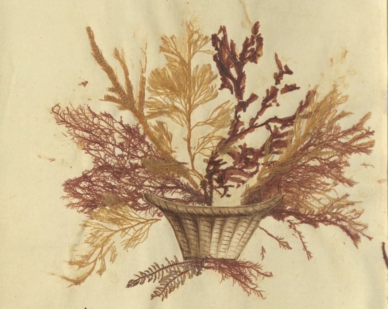
I. Two summers ago, we drove up the driveway of the Bennington Museum. The museum welcomed visitors with its new portico and greeted them with advertisements for its Grandma Moses collection. I wasn’t interested in Grandma Moses that day. I had come to Vermont looking for archival gems, a taste my family and friends sometimes find hard to understand. I remembered that Kenneth Zogry, the Bennington Museum’s curator, had organized a wonderful exhibit in 1995: “The Best the Country Affords: Vermont Furniture, 1765-1820.” His catalogue’s fascinating documentary references suggested that I might find an abundance of information on furniture makers and furniture owners in the museum’s archives: file folders stuffed with clippings, stories to fill out my case studies of provincial craftsmen and consumers after the Revolution. As often happens, the files were disappointing. The black loose-leaf binders held a wealth of material on the furniture that Zogry had found on his travels to private homes and local historical societies. Zogry’s files document the universe of furniture made in Vermont and, perhaps, let him make new attributions, but they did not contain the stories of craftsmen and their customers I was looking for that day. Only when I finally wandered out into the sunlit main gallery where the museum’s treasures were displayed–its objects from Vermont’s early history–did I begin to see the kinds of things that would help me understand how artisans and consumers imagined their worlds. The first thing that caught my eye was a large neoclassical sideboard, looking for all the world like a sophisticated Boston bowfront, but made in Windsor, Vermont. But the beautiful bowfront, even with its sleek lines, could not compare with the massive desk and encyclopedia-filled bookcase that dominated an entire corner of the room, where the museum staff had recreated the interior of an early-nineteenth-century Vermont home (fig. 1).

The desk, I learned, belonged to James Wilson of Bradford, Vermont. More interesting, the label stated Wilson was the United State’s first globe maker, and indeed, one of Wilson’s early globes sat in a plexiglass case in front of the display. It seemed strange to me then that a man in this out-of-the-way place had taken to making globes (fig. 2).

Or perhaps it is the people of the provinces who best understand the need for assuring a good local source for things like maps. We know nineteenth-century Vermonters were intellectually sophisticated cosmopolitans of a sort. At the other end of the room stood a marvelous musical tall clock built by a Rutland clock-making partnership. The timepiece boasted a calendar wheel and a moon dial, and it played seven tunes, one for each day of the week, and added a psalm for Sunday. Between the globe and the clock, museum curators had hung a 1795 landscape of Bennington painted by Ralph Earl, a well-known Connecticut portraitist. Earl was likely the first painter to visit the town, where he produced this very early example of an American landscape. The museum’s local treasures preserved Vermont’s contribution to the new nation’s commercial and cultural history. The objects on display were connected by their visual power and by their local historical significance, but they also recorded the curiosity and intellectual ambitions of men and women of rural New England. I left the Bennington Museum that day enthralled with the discovery of James Wilson, wanting to know more about how a globe maker could have come out of the upper Connecticut River Valley in the 1790s. As I later learned, others in the hinterlands also tried to make globes; New Hampshire shoemaker, surveyor, and farmer Samuel Lane, for example, made his own idiosyncratic version of a terrestrial globe around 1760. Lane turned a seven-inch oak sphere on his lathe, scored the painted surface, and cut degrees and continental boundaries into the painted surface, while pinning it into a pine table made in the form of a milking stool so it could revolve. I was also vaguely aware of the new scholarly history of cartography, but I had little idea how the four corners of that gallery would come together into my fascination with the Village Enlightenment. Wilson was not the only New Englander to fashion a career out of his own curiosity; in the 1790s many Americans made money satisfying country folks’ interest in the latest mechanical marvels, like the complex musical clock, or their desire to own the maps that let them see the shape and extent of their new nation.
II. Curiosity Unleashed Globes captured James Wilson’s imagination. Few eighteenth-century American households could boast owning a globe. Those who did likely purchased their globes from London manufacturers. Instrument makers, engravers, and clock makers all produced globes in Britain. Many considered “cordwainer” William Bardin the leading late-eighteenth-century globe maker. Bardin and others relied on forms introduced with Martin Behaim’s hollow wooden Nuremburg globe of 1492. Behaim’s globe making principles were codified and transmitted in print in Diderot’s Encyclopedie, the source of information contained in Wilson’s own Encyclopedia Britannica. Globe makers who followed Behaim’s example used a solid wood mould with wire pivots at each end, which became the poles. The ball was covered with successive layers of damp papier-mâché or paper. When the paper dried, the shell was cut into two halves around the circumference of the equator, an axle shaft of wood was tacked at the poles, and the globe put back together and sealed. Thin layers of plaster were applied and guidelines drawn so that printed gores could be attached. The discovery of gores–the map of the world broken into twelve sections–solved the problem of how to fit flat paper maps over spheres. In the early sixteenth century, engravers and printers began to produce gores for eager globe makers. Globe making thus sat at the intersection of woodworking, metalworking, printing, and mapmaking, as Wilson would soon discover. In the eighteenth century, globe making caught fire. Interest was fueled by the era’s expansion of geographical knowledge, thanks to traders and explorers, especially Captain James Cook. Cook’s Pacific voyages rounded out European knowledge of the world. The information he brought back gave Enlightenment globes their marked “oceanic character,” as geographer Denis Cosgrove has reminded us. Cook’s voyages captured Americans’ imagination, too. There was a growing interest in popular science and geographic discoveries in elite and not so elite circles along with a desire to display that newfound knowledge in homes and schools. Wilson shared this interest, but how did he come to make globes? Wilson was born in Londonderry, New Hampshire, in 1763. As a boy, he learned blacksmithing from his uncle. In 1795 the young James Wilson set out west across the Connecticut River to locate land for his family in Bradford, Vermont, a town located at the scenic Coos Meadows, where the Waits and Connecticut Rivers meet. Along the way, he stopped in Hanover, New Hampshire, to see a friend at Dartmouth College. According to one family story, the young man, himself eager for knowledge but without the means for securing a formal education, saw a pair of globes when he peaked through the keyhole of a locked door in one of the college buildings. The college owned three sets of globes in the 1790s. We don’t know which globes Wilson saw, but we do know that these orbs remained inaccessible to him. Wilson could not have purchased the globes, nor could he have purchased the education that would have let him study Dartmouth’s small collection. This glimpse of globes, however, fired his curiosity and fortified his desire to construct one of these unusual objects, or so the story of James Wilson goes. Before he could take up globe making, he had to settle his family. He brought his wife and two sons to Bradford to develop his homestead, and began making axes to help pay for his land purchases. Although still working as a smith, he did not forget his interest in making a map of the world, and in 1796 he made his first globe, a large solid wooden ball covered with paper, with the continents and countries drawn in pen and ink. But Wilson would not be satisfied with his hand-drawn maps. He intended to build and market a product that could compete with the European imports, making his mark and earning his living as an American globe maker. Wilson’s first effort looked something like a globe, but it could hardly compete with the European imports. And Wilson, with his limited resources, faced formidable obstacles on his way to success as a globe maker. First, he knew very little about either geography, astronomy, or cartography. However, for a man gifted with Wilson’s capacity for curiosity, the growing number of books and newspapers in the small towns of northern New England offered many sources of information. Wilson may not have had the advantages of his friend at Dartmouth, but he did have skills and products he could exchange for knowledge. He sold off some of his farm produce and livestock and purchased for the substantial sum of $130 the eighteen volumes of the Encyclopaedia Britannica: Or a Dictionary of Arts, Sciences and Miscellaneous Literature, the collection of books for which he built his imposing desk and bookcase (fig. 3).

Encyclopedias were the archetypal repository of the Enlightenment, with their compendia of all recognized knowledge; the third edition Britannica contained almost fifteen thousand pages and over five hundred plates, but Wilson would have been particularly interested in the substantial entries on globes and geography. Wilson had his encyclopedia, but how was he to translate the information he found there onto his wooden spheres? His bookcase demonstrated his skills in woodworking, and as a trained blacksmith he was a proficient metal worker. But he knew that hand-drawn globes could not compare with European imports. In order to move beyond shoemaker Lane’s effort and produce globes his neighbors would be proud to own, Wilson had to learn to engrave his maps on copper plates. Wilson knew he needed to find a teacher more skilled at engraving than his acquaintances in southern Vermont. He set out for New Haven to find Amos Doolittle, a silversmith turned engraver, who was celebrated as the man who had engraved the maps in Jedidiah Morse’s Geography Made Easy (1784), the first geography text published in the United States. After a brief stay in New Haven, Wilson returned to Vermont a blacksmith now turned geographer/engraver. But he still had much to learn about building globes. He began again with his original globe, covering it with papier-mâché, gluing several layers together, tracing continental outlines, cutting paper into hemispheres, and then gluing the hemispheres onto the sphere. He finished a first hand-drawn globe, but then spent nearly a year engraving a world map on a large copper plate, only to discover that he did not know how to project the meridians of the map, a flat plane, in their true proportion onto a spherical surface. Wilson took off once again in search of cosmopolitan training to suit his cosmopolitan imagination. This time he went to see the “Father of American Geography,” Jedidiah Morse himself, at Charlestown, Massachusetts. Morse told the globe maker that his first effort on a copper plate could not be salvaged. Wilson went back to Bradford, knowing he needed to obtain more copper but knowing too that his growing family needed the scarce resources he was spending learning to make globes. In the first years of the nineteenth century, balancing family demands and map-making aspiration, Wilson worked on his globe making. He built his own tools–lathes and presses–mixed his inks, shaped the spheres, and printed all of his own maps, probably relying on increasingly available atlases. Around 1810 he produced his first globes of paper on a paper core suspended in a birch frame with turned legs. He opened a shop to manufacture these prized items and began to sell them to his neighbors in rural Vermont. Wilson charged around fifty dollars for a pair of globes: a terrestrial and a celestial one. Vermonters were likely proud to possess one of Wilson’s impressive terrestrial globes. They measured thirteen inches in diameter, and each was signed, “A NEW TERRESTRIAL GLOBE . . . By J. WILSON, VERMONT.” Wilson’s proud signature suggests that we have entered an era that celebrated homegrown and democratized knowledge (fig. 4).

of Congress
Men like Wilson made a livelihood providing useful knowledge and genteel commodities. American globes or provincial sideboards were material manifestations of a Village Enlightenment. Clocks or globes, for example, displayed the enlightened age’s fascination with mechanical marvels and the quest for knowledge of distant explorations, while also the refined person’s desire to display symbols of gentility.
III. Curiosities for Sale Maps and globes were important products for people eager to see themselves as members of a new nation. What is surprising is that so many of the nation’s early maps came from places like Wilson’s Bradford globe manufactory. Wilson and his Windsor County neighbors formed a remarkable circle of map makers and engravers whose products graced the walls of schoolhouses and homes of Vermont and the entire nation. We sometimes picture a man like Wilson as a sort of solitary genius imagining his way into a world outside rural Vermont. But he was well supplied with coworkers. From the tiny villages of Greenbush and Feltchville a cluster of more than half a dozen rural artisans, printers, and engravers produced visual representations of Vermont, in maps, prints, and illustrated books. The men and women of this “Greenbush group,” were connected by partnerships, marriages, apprenticeships, and collaborations. Their intellectual, financial, and family connections helped spread knowledge through the countryside. They helped build a world where Enlightenment and edification were interwoven with the growing commercialization of the countryside. Maps were important components of this new world. They facilitated geographic and economic integration, but they also helped people imagine their nation. Maps have long aided political expansion and cultural consolidation. In the early Republic cartography helped establish an image of an authentically bounded nation. “After the Revolution many Americans self-consciously turned to the discourse of geography to negotiate and transform the representations of personal, regional, and political difference into material figures of national consent,” literary scholar Martin Bruckner writes. Whenever they stitched a sampler of the United States or gazed on a state map that made their homes part of a larger whole, they “enacted the nation as a participatory model of coherence.”

In fact, state maps, not globes, were the first American cartographic efforts after Independence, and Vermont was or became the first state with a map: William Blodget’s “A Topographical Map of the State of Vermont.” But Blodgett’s map did little to enhance this map maker’s finances. Scottish surveyor James Whitelaw fared far better; he succeeded Ira Allen as Vermont’s surveyor-general and kept busy securing new surveys of the state’s towns. From these surveys, he compiled his “A Correct Map of the State of Vermont,” to which he added details about the state’s commercial and manufacturing activities. The legend on Whitelaw’s map included familiar icons such as forts and meeting houses, but he added grist, saw, and fulling mills, along with grammar schools and other signs of a landscape of industrial and cultural improvement. The map’s large cartouche contained a delightful pastoral scene that featured the ongoing work of agricultural development taking place throughout the state: an improving farm with its cleared fields, a stump in foreground, and a two story farmhouse in the back (fig. 6).

Whitelaw’s publisher was New Haven’s Doolittle in 1796, but later editions (including an 1810 map engraved by James Wilson) would come from Vermont sources. About 1810, a man named Isaac Eddy established a shop in the little hamlet of Greenbush in a western corner of Weathersfield. Eddy and his son, apprentices, and business partners would turn this remote village into a significant center of early national engraving, especially cartographic work. The Eddys produced an amazing volume of maps, illustrated books, and even globes. Eddy embarked upon a modest program of imprints and engraved plates for the “First Vermont Edition” of the Bible along with a series of other local publications. His most ambitious collaboration, however, came with James Wilson on their Chronology Delineated / To Illustrate the History of Monarchical Revolutions (fig. 7).

These two rural entrepreneurs and encyclopaedists mapped the long history of the world, marrying commerce and culture together in two 36-x-21-inch sheets to be placed together, graphically representing the growth of the nations of the world from the time of Adam to the present. Eddy published this visual history to bring the allure and exoticism of its “French Historian and Chronologer” to an American audience with “the most concise and accurate system of chronology ever published,” offering the “Patrons of the Fine Arts . . . useful, amusing and ornamental” information. Eddy and Wilson obviously shared a kind of world vision. Knowledge more local sufficed for other intellectual entrepreneurs. Whitelaw’s Vermont map, for example, had a long life among other Windsor County engravers. Ebenezer Hutchinson brought out new editions in 1821 and 1824. In new editions, a vision of place transformed by enterprise and industry gradually replaced the pastoral scenes depicted in 1795 and 1810. Two cartouches graced the 1824 map; one depicted the thriving village of Montpelier from the mill point; the other was a fantastic scene looking west (fig. 8).

The wilderness with its thunderous waterfall and roving wildlife was divided by an earthen urn with the map’s title, the state seal, and an eagle above the whole, leading on to a cultivated scene with a farmer and his livestock in the foreground, a plough crossing the fields in the middle ground, and then a river with a puffing steamboat going by. Across the shore stood an urban scene. The Greenbush group innovated with new map styles and advanced production techniques. Another Eddy apprentice, George White struck out on his own with some smaller and less detailed maps of the two states straddling the Connecticut River. Lewis Robinson, yet one more product of Eddy’s workshop, pushed the manufacturing process forward, and built the first “map manufactory” in Windsor County. In the second quarter of the nineteenth century, Lewis Robinson became the leading purveyor of maps in northern New England, a major producer in the entire United States, all without leaving his hometown (Fig. 9).

The little village of South Reading stayed the site of his map factory for thirty-eight years; his chief products maps of Vermont and New Hampshire. They ranged in price from thirty-three cents to three dollars, often marketed through a network of peddlers and traveling salesmen. Robinson sold nearly six thousand maps between 1840 and 1855 alone and made his little village “a thriving backwoods center of commercial American cartography,” as Vermont cartographic historian J. Kevin Graffagnino has written.
IV. Curiosity Completed Wilson continued to operate his backwoods shop in Bradford, but eventually success forced him to open an urban shop. Events deep in the Pacific and across the North American continent captured Wilson’s imagination, and as he gained new information, he corrected his globes. On “A NEW AMERICAN TERRESTRIAL GLOBE on which the PRINCIPAL PLACES of the KNOWN WORLD are ACCURATELY laid down with the traced attempts of CAPTAIN COOK to discover a Southern Continent by James Wilson, 1811,” Wilson filled out the continent with place names and river systems. In 1817 Wilson’s sons opened a factory in Albany, New York, to meet the increased demand for their globes and maps. Knowing there was a market for inexpensive maps, the Wilsons even produced three-inch terrestrial and celestial globes.

The three-inch globes offered less graphic detail than larger maps; citizens of the new nation eager to learn and display their knowledge of the world could easily afford these miniature maps. An 1828 broadside advertised the Wilsons’ full range of three-inch to thirteen-inch globes on mahogany pedestal stands. “THE CORRECTNESS OF THE GEOGRAPHICAL DIVISIONS &C. OF OUR OWN country, and the western hemisphere, renders these globes more useful and interesting to the American geographer, and gives them a decided preference to imported globes, on which this continent is greatly misrepresented.” Wilson’s globes were also less expensive than imported ones, “so schools and academies, even private families,” could take advantage, with the “popularity and usefulness of Geographical and Astronomical science,” facts so apparent to potential customers that it was not necessary to explain either their popularity or utility. Material objects like Wilson’s globes made the Village Enlightenment. They remind us that we sometimes too readily dismiss the backwoods as a source of information. The modern model of an urban monopoly on curiosity and sophistication fails to capture the intellectual world of James Wilson and his neighbors. Globes and other cartographic instruments served well as an exemplary archive of knowledge, quickly adding the “discoveries” of explorers such as Captain Cook, and modeling an ideal: the creation of a natural and orderly society. Commerce and culture came together in a process, really a transformation, that I have called elsewhere the Village Enlightenment, where men and women made a business of providing and using cultural commodities in the hinterlands. Entrepreneurs like Wilson took advantage of the curiosity fostered in schoolrooms and popular books and helped promote the democratization of knowledge and the commercialization of the countryside. This widespread movement made rural peoples’ homes looks very different in the decades after the War for Independence and celebrated the new nation’s maturity, making something European into something American and moving the center of that story from its familiar setting of Philadelphia or New York far into inland communities. Bradford, Vermont, a town perched along the upper Connecticut River where James Wilson set up his globe-making shop, was the unlikely station for such a story. The farmer-blacksmith’s remarkable saga offers a vision of one, only one of many, backwoods savants navigating among the arts and sciences to produce new commercial goods and cultural identities. James Wilson’s curiosity opens up all sorts of possibilities of learning from artifactual evidence: a lesson well worth sharing.
Further Reading: The study of Vermont cartography begins with J. Kevin Graffagnino, The Shaping of Vermont: From the Wilderness to the Centennial, 1749-1877 (Rutland, Vt., 1983) with its reproduction of maps, account of their makers, and the historical background. Many of the James Wilson documents appear in Leroy E. Kimball, “James Wilson of Vermont, America’s First Globe Maker,” Proceedings of the American Antiquarian Society 48 (April 1938): 29-48; Harold W. Haskins, “James Wilson–Globe Maker,” Vermont History 27 (October 1959): 319-30. Wilson also appears in recent studies of Vermont material culture such as Kenneth Zogry’s comprehensive survey of Vermont furniture: The Best the Country Affords: Vermont Furniture, 1765-1850 (Bennington, Vt., 1995) and Celebrating Vermont: Myths and Realities (Middlebury, Vt., 1991) edited by Nancy Price Graff. Upper Valley material culture gets important consideration in Gerald Ward and William Hosley, The Great River: Art & Society of the Connecticut Valley, 1635-1820(Hartford, 1985). For some keen thinking on the relation of provincial and metropolitan cultural relations in furniture and other material forms, see Kevin Sweeney’s “High Style Vernacular: Lifestyles of the Colonial Elite,” in Cary Carson, Ronald Hoffman, and Peter J. Albert, Of Consuming Interests: The Style of Life in the Eighteenth Century (Charlottesville, 1994), 1-58; or Philip Zea’s “Diversity and Regionalism in Rural New England Furniture,” in American Furniture (1995). My Village Enlightenment essay is concerned with print materials: “The Village Enlightenment in New England,” William and Mary Quarterly 47 (July 1990): 327-46. Specific studies of the “Greenbush Group” include Windsor County Engravers, 1809-1860 (Montpelier, Vt., 1982); George R. Dalphin and Marcus A. McCorison, “Lewis Robinson–Entrepreneur,” Vermont History 30 (Oct 1962): 297-313; Carl Taylor Jr., “George White–Vermont’s ‘Unknown Artist,’” Vermont History 42 (Winter 1974): 3-11; Harold Goddard Rugg, “Isaac Eddy Printer-Engraver,” Bibliographical Essays: A Tribute to Wilberforce Eames (Cambridge, 1924): 313-29. The single most important figure in the “new history of cartography” was J.B. Harley, author of The New Nature of Maps (Baltimore, 2001); the early republic has seen some good recent work by John Rennie Short, Representing the Republic: Mapping the United States, 1600-1900 (New York, 2001) and Martin Bruckner, “Lessons in Geography: Maps, Spellers, and Other Grammars of Nationalism in the Early Republic,” American Quarterly 51 (June 1999): 311-44; Matthew Edney, “Reconsidering Enlightenment Geography and Map Making: Reconnaissance, Mapping, Archive,” in David N. Livingstone and Charles W. J. Withers, Geography and Enlightenment (Chicago, 1999): 165-98. Denis Cosgrove has written a sweeping and imaginative study of the cartographic imagination and globes: Apollo’s Eye: A Cartographic Genealogy of the Earth in the Western Imagination (Baltimore, Md., 2001). Finally, collectors and historians of maps and globes have been busy online. David Rumsey’s important map collection has thorough documentation and impressive graphics. Library of Congress collections are available in the American Memory collections. Two other useful Websites are the Osher Map Library at the University of Southern Maine with several online exhibitions and Cartographic Curiosities at Yale.
This article originally appeared in issue 4.2 (January, 2004).
David Jaffee passed away in 2017. He previously taught history and new media pedagogy at City College of New York and the Graduate Center, CUNY.